1
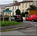
Hengoed Gospel Hall, Davies Street, Ystrad Mynach
The building dates from 1900. https://www.geograph.org.uk/photo/5997292 to the information board on display in December 2018.
Image: © Jaggery
Taken: 10 Dec 2018
0.03 miles
2
Information board for Hengoed Gospel Hall
On the wall here https://www.geograph.org.uk/photo/5997288 viewed in December 2018.
Image: © Jaggery
Taken: 10 Dec 2018
0.04 miles
3
Hengoed Gospel Hall
Image: © John Lord
Taken: 26 Aug 2017
0.04 miles
4
Southern boundary sign, Hengoed
Alongside Bedwlwyn Road viewed from the northern edge of Ystrad Mynach.
The road bridge and parallel footbridge span a railway.
The Dilwyn Avenue junction is in the background on the left.
Image: © Jaggery
Taken: 10 Dec 2018
0.04 miles
5
Ordnance Survey Rivet
This OS rivet can be found on the east parapet of the railway bridge. It marks a point 134.895m above mean sea level.
Image: © Adrian Dust
Taken: 8 Jun 2019
0.04 miles
6
Road bridge over the railway, Bedwlwyn Rd, at the boundary of Ystrad Mynach and Hengoed
Image: © John Lord
Taken: 26 Aug 2017
0.05 miles
7
West side of Davies Street, Ystrad Mynach
Brick houses alongside the descent to Pengam Road.
Image: © Jaggery
Taken: 10 Dec 2018
0.05 miles
8
Ystrad Mynach boundary sign facing Hengoed
On the corner of Davies Street and Bedwlwyn Road at the northern edge of Ystrad Mynach.
In December 2018 the top of the sign is distorted. The Hengoed boundary sign https://www.geograph.org.uk/photo/5997282 is near the camera.
Image: © Jaggery
Taken: 10 Dec 2018
0.05 miles
9
Avenue Close, Ystrad Mynach
A cul-de-sac of 2 semi-detached bungalows viewed from the western end of The Avenue, close to Davies Street.
Image: © Jaggery
Taken: 27 Aug 2010
0.05 miles
10
Ildiwch/Give Way, Davies Street, Ystrad Mynach
The Welsh/English sign faces Davies Street at the Pengam Road junction.
Image: © Jaggery
Taken: 10 Dec 2018
0.05 miles


