1
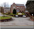
Sunny View, Pontlottyn
Sunny View is a cul-de-sac on the south side of Fochriw Road.
Image: © Jaggery
Taken: 2 Aug 2018
0.03 miles
2
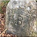
Old Boundary Marker near Sunny View, Pontlottyn
Mine Boundary Marker beside a metal gate on a path up the hillside above Sunny View, Pontlottyn. Rhymney community. The coronet and B represent the Marquess of Bute and similar stones have marked mining rights, see http://www.industrialgwent.co.uk/h21-boundary/index.htm#atoc.
Milestone Society National ID: GLA_RHYM01em
Image: © S Bates
Taken: 18 Sep 2022
0.04 miles
3
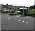
Sunny View bus stop and shelter, Pontlottyn
This stop alongside Fochriw Road near the corner of Sunny View is for buses to Bargoed via Fochriw and Pentwyn.
Image: © Jaggery
Taken: 2 Aug 2018
0.04 miles
4
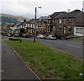
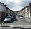
Fochriw Road houses and cars, Pontlottyn
On the south side of the road. The house on the left is on the corner of Sunny View.
Image: © Jaggery
Taken: 2 Aug 2018
0.05 miles
5
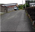
From Fochriw Road to Farm Road, Pontlottyn
The road bends past the Sunny View junction.
Image: © Jaggery
Taken: 2 Aug 2018
0.06 miles
6
Vicarage Lane, Pontlottyn
Steep ascent from the A469 opposite Greenfield Street. https://www.geograph.org.uk/photo/5872830
Image: © Jaggery
Taken: 27 Jul 2018
0.06 miles
7
Valley Manor Care Home, Pontlottyn
Set back from the west side of the A469.
Image: © Jaggery
Taken: 19 Apr 2013
0.07 miles
8
Duffryn Street, Pontlottyn
Duffryn Street is a 110 metre long residential street between Fairview Terrace
at the camera end and the A469 Southend Terrace ahead.
Image: © Jaggery
Taken: 19 Apr 2013
0.07 miles
9
Valley Manor Senior Citizens Home, Pontlottyn
Set back 35 metres from the west side of the A469.
Image: © Jaggery
Taken: 27 Jul 2018
0.07 miles
10
Ordnance Survey Cut Mark
This OS cut mark can be found on No1 Southend Terrace. It marks a point 265.691m above mean sea level.
Image: © Adrian Dust
Taken: 29 Sep 2018
0.07 miles


