
IMAGES TAKEN NEAR TO
Pontlottyn Link Road, BARGOED, CF81 9QF
Introduction
This page details the photographs taken nearby to Pontlottyn Link Road, CF81 9QF by members of the Geograph project.
The Geograph project started in 2005 with the aim of publishing, organising and preserving representative images for every square kilometre of Great Britain, Ireland and the Isle of Man.

There are currently over 7.5m images from over14,400 individuals and you can help contribute to the project by visiting https://www.geograph.org.uk
Image Map
Images are licensed for reuse under creativecommons.org/licenses/by-sa/2.0
Notes
- Clicking on the map will re-center to the selected point.
- The higher the marker number, the further away the image location is from the centre of the postcode.
Image Listing (111 Images Found)
Images are licensed for reuse under creativecommons.org/licenses/by-sa/2.0
Image
Details
Distance
1
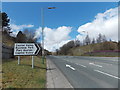
Right turn for Capital Valley Business Park, Pontlottyn
Viewed across the A469.
Image: © Jaggery
Taken: 19 Apr 2013
0.06 miles
3
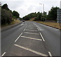
Bend in the A469, Pontlottyn
Ahead for Rhymney and the Heads of the Valleys Road.
The right turn in the distance leads to Capital Valley Business Park.
Image: © Jaggery
Taken: 27 Jul 2018
0.07 miles
4
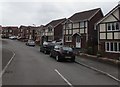
North Rising, Pontlottyn
Cul-de-sac of detached houses on the north side of Heol Evan Wynne.
Image: © Jaggery
Taken: 27 Jul 2018
0.08 miles
5
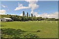
Harper's Wembley
Pontlottyn Welfare Ground.
Image: © Mel hartshorn
Taken: 29 May 2015
0.08 miles
6
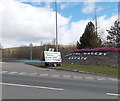
Name at the entrance road to Capital Valley Business Park, Pontlottyn
Viewed across the A469.
Image: © Jaggery
Taken: 19 Apr 2013
0.08 miles
7
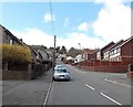
Heol Evan Wynne, Pontlottyn
Heol Evan Wynne climbs away from Merchant Street past the right turn for houses in North Rising.
In the distance, the road is fittingly renamed Hill Road as the gradient increases to 20% (1 in 5).
Image: © Jaggery
Taken: 19 Apr 2013
0.08 miles
8
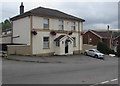
Lord Nelson, Heol Evan Wynne, Pontlottyn
Hotel and pub viewed from the corner of Hill Road and Farm Road.
Image: © Jaggery
Taken: 27 Jul 2018
0.08 miles
9
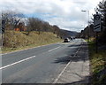
A469 descends towards the NW edge of Pontlottyn
Heading southeastwards, the A469 from Rhymney approaches Pontlottyn.
The road signs with two black lines are countdowns to the 30mph zone ahead. 100 metres ahead are two similar signs, but with only one black line. Beyond them are the 30mph speed limit signs.
Image: © Jaggery
Taken: 19 Apr 2013
0.08 miles
10
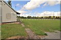
Harper's Wembley
Pontlottyn Football Grounds.
Image: © Mel hartshorn
Taken: 29 May 2015
0.09 miles