A469 descends towards the NW edge of Pontlottyn
Introduction
The photograph on this page of A469 descends towards the NW edge of Pontlottyn by Jaggery as part of the Geograph project.
The Geograph project started in 2005 with the aim of publishing, organising and preserving representative images for every square kilometre of Great Britain, Ireland and the Isle of Man.

There are currently over 7.5m images from over 14,400 individuals and you can help contribute to the project by visiting https://www.geograph.org.uk
A469 descends towards the NW edge of Pontlottyn
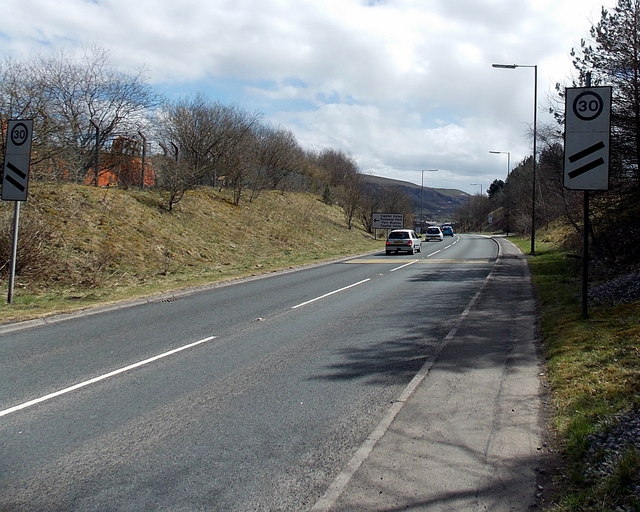
Image: © Jaggery Taken: 19 Apr 2013
Heading southeastwards, the A469 from Rhymney approaches Pontlottyn. The road signs with two black lines are countdowns to the 30mph zone ahead. 100 metres ahead are two similar signs, but with only one black line. Beyond them are the 30mph speed limit signs.
Images are licensed for reuse under creativecommons.org/licenses/by-sa/2.0
Image Location
Latitude
51.750519
Longitude
-3.28515