1
The Mount Pleasant, Pentwyn
Pub in the small village of Pentwyn, located between Deri and Fochriw.
The road here is 400 metres (c1,310 ft) above mean sea level.
Image: © Jaggery
Taken: 11 Jul 2018
0.00 miles
2
Mount Pleasant Inn, Pentwyn, Fochriw
Built in 1858.
Pentwyn once consisted of many houses occupied by mine workers. Now only one terrace http://www.geograph.org.uk/photo/3249578 and another public house http://www.geograph.org.uk/photo/537530 remain.
Image: © Robin Drayton
Taken: 28 Nov 2012
0.01 miles
3
Mount Pleasant pub, Pentwyn
Pub in the small village of Pentwyn, located between Deri and Fochriw.
Viewed from the road to Bargoed via Gelligaer.
Image: © Jaggery
Taken: 11 Jul 2018
0.01 miles
4
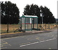
Bus stop and shelter, Pentwyn
In July 2018 this is a stop on Stagecoach bus route 1 from Bargoed to Merthyr Tydfil via Deri, Pentwyn and Fochriw.
Image: © Jaggery
Taken: 11 Jul 2018
0.01 miles
5
Road leading through Pentwyn near Rhymney
Image: © Colin Park
Taken: 19 Oct 2013
0.01 miles
6
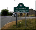
Northern boundary of Pentwyn
Pentwyn is part of the Darran Valley community in the County Borough of Caerphilly.
The text on the sign is in English and Welsh.
Image: © Jaggery
Taken: 11 Jul 2018
0.02 miles
7
Grid across the road through Pentwyn
A nearby warning sign https://www.geograph.org.uk/photo/5838640 shows Cattle Grid though the grid is more likely to be a sheep grid based on the animal droppings I saw in this area today. Horsedrawn vehicles and horse riders can use the gate on the right to bypass the grid.
Image: © Jaggery
Taken: 11 Jul 2018
0.02 miles
8
Tafarn Mount Pleasant Inn, Pentwyn
Tafarn y Mount Pleasant ym Mhentwyn ger Fochriw.
The Mount Pleasant Inn in Penwtwyn near Fochriw
Image: © Alan Richards
Taken: 9 Sep 2012
0.02 miles
9
Bus stop and shelter in Pentwyn
Located near the Mount Pleasant https://www.geograph.org.uk/photo/5922903 this stop is for buses to Bargoed via Deri.
Image: © Jaggery
Taken: 11 Jul 2018
0.02 miles
10
Warning sign - cattle grid, Pentwyn
On the approach to this grid. https://www.geograph.org.uk/photo/5838601
Horsedrawn vehicles and horse riders can use the gate on the right to bypass the grid.
Image: © Jaggery
Taken: 11 Jul 2018
0.02 miles


