1
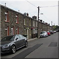
School Street, Deri
Towards St Peter's Church https://www.geograph.org.uk/photo/5840365 which was originally a National School, hence the street name.
Image: © Jaggery
Taken: 12 Jul 2018
0.03 miles
2
Deri Medical Centre, Riverside Walk, Deri
Image: © Jaggery
Taken: 12 Jul 2018
0.03 miles
3
NNW along School Street, Deri
Looking to the north northwest towards Mill Road from near St Peter's Church. https://www.geograph.org.uk/photo/5840365
Image: © Jaggery
Taken: 12 Jul 2018
0.03 miles
4
Entrance gate to St Peter's Church, Deri
From School Street to this https://www.geograph.org.uk/photo/5840365 church.
Image: © Jaggery
Taken: 12 Jul 2018
0.03 miles
5
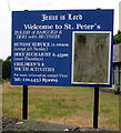
Information board outside St Peter's Church, Deri
On the right here https://www.geograph.org.uk/photo/5840365 viewed in July 2018.
Image: © Jaggery
Taken: 12 Jul 2018
0.03 miles
6
Row of stone houses, School Street, Deri
The telephone pole is opposite Brecon Terrace. https://www.geograph.org.uk/photo/5840326
Image: © Jaggery
Taken: 12 Jul 2018
0.04 miles
7
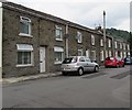
West side of School Street, Deri
Houses between Brecon Terrace and Mill Road.
Image: © Jaggery
Taken: 12 Jul 2018
0.04 miles
8
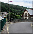
Black bench at a bend in School Street, Deri
Viewed from the corner of Mill Road. Double yellow lines on
both sides of School Street indicate no parking at any time.
Image: © Jaggery
Taken: 12 Jul 2018
0.04 miles
9
St Peter's Church, School Street, Deri
In the Church in Wales Parish of Bargoed & Deri with Brithdir in the Diocese of Llandaff. The building dates from before 1873 when it appears on the first edition Ordnance Survey map as a National School. The building had become a Mission Church by 1900.
Image: © Jaggery
Taken: 12 Jul 2018
0.04 miles
10
Junction of School Street and Mill Road, Deri
School Street viewed across Mill Road.
Image: © Jaggery
Taken: 12 Jul 2018
0.04 miles


