St Peter's Church, School Street, Deri
Introduction
The photograph on this page of St Peter's Church, School Street, Deri by Jaggery as part of the Geograph project.
The Geograph project started in 2005 with the aim of publishing, organising and preserving representative images for every square kilometre of Great Britain, Ireland and the Isle of Man.

There are currently over 7.5m images from over 14,400 individuals and you can help contribute to the project by visiting https://www.geograph.org.uk
St Peter's Church, School Street, Deri
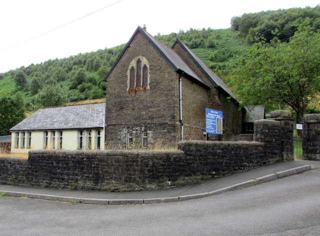
Image: © Jaggery Taken: 12 Jul 2018
In the Church in Wales Parish of Bargoed & Deri with Brithdir in the Diocese of Llandaff. The building dates from before 1873 when it appears on the first edition Ordnance Survey map as a National School. The building had become a Mission Church by 1900.
Images are licensed for reuse under creativecommons.org/licenses/by-sa/2.0
Image Location
Latitude
51.70634
Longitude
-3.263057