1
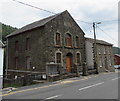
Ysgwyddgwyn Presbyterian Church, Deri
Image: © Robin Drayton
Taken: 22 Aug 2007
0.09 miles
2
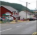
Bailey Street bus stop and shelter, Deri
This stop for buses to Bargoed.
Image: © Jaggery
Taken: 12 Jul 2018
0.09 miles
3
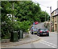
Telecoms cabinets, New Road, Deri
Viewed in July 2018. No cabinets were here in an August 2011 Google Earth Street View.
Image: © Jaggery
Taken: 12 Jul 2018
0.09 miles
4
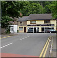
Perfection @ Reflection in Deri
Hair & beauty salon at 5 New Road viewed in July 2018.
An August 2011 Google Earth Street View shows Deri Fish & Chip shop at 5 New Road.
Image: © Jaggery
Taken: 12 Jul 2018
0.09 miles
5
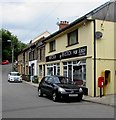
Queen Elizabeth II postbox, New Road, Deri
At the edge of Perfection @ Reflection hair salon.
Image: © Jaggery
Taken: 12 Jul 2018
0.09 miles
6
1868 tablet on Ysgwyddgwyn Presbyterian Church, Deri
The Welsh language tablet is above the windows here. https://www.geograph.org.uk/photo/5839871 It records that this was a Calvinistic Methodist place of worship when built in 1868 (replacing the original 1808 building). In 2018, this is a Presbyterian church. https://www.geograph.org.uk/photo/5839876
Image: © Jaggery
Taken: 12 Jul 2018
0.10 miles
7
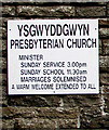
Ysgwyddgwyn Presbyterian Church information board, Deri
On the wall of this https://www.geograph.org.uk/photo/5839871 church in July 2018.
Image: © Jaggery
Taken: 12 Jul 2018
0.10 miles
8
Ysgwyddgwyn Presbyterian Church, Deri
Viewed across Bailey Street. This is the 1868 rebuild of the original dating from 1808 when Deri was known as Ysgwyddgwyn. The village was renamed Deri later in the 19th century after many incomers to the area, who had come for work in the colliery, could not pronounce Ysgwyddgwyn.
Image: © Jaggery
Taken: 12 Jul 2018
0.10 miles
9
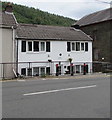
White cottage, Bailey Street, Deri
Darren Cottage is on the north side of Ysgwyddgwyn Presbyterian Church. https://www.geograph.org.uk/photo/5839871
Image: © Jaggery
Taken: 12 Jul 2018
0.10 miles
10
Bailey Street houses near the Bailey's Arms , Deri
The edge of the Bailey's Arms https://www.geograph.org.uk/photo/5843509 is on the right.
Image: © Jaggery
Taken: 12 Jul 2018
0.10 miles


