Ysgwyddgwyn Presbyterian Church, Deri
Introduction
The photograph on this page of Ysgwyddgwyn Presbyterian Church, Deri by Jaggery as part of the Geograph project.
The Geograph project started in 2005 with the aim of publishing, organising and preserving representative images for every square kilometre of Great Britain, Ireland and the Isle of Man.

There are currently over 7.5m images from over 14,400 individuals and you can help contribute to the project by visiting https://www.geograph.org.uk
Ysgwyddgwyn Presbyterian Church, Deri
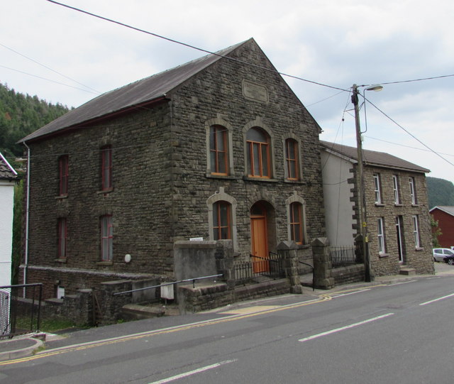
Image: © Jaggery Taken: 12 Jul 2018
Viewed across Bailey Street. This is the 1868 rebuild of the original dating from 1808 when Deri was known as Ysgwyddgwyn. The village was renamed Deri later in the 19th century after many incomers to the area, who had come for work in the colliery, could not pronounce Ysgwyddgwyn.
Images are licensed for reuse under creativecommons.org/licenses/by-sa/2.0
Image Location
Latitude
51.709278
Longitude
-3.265744