1
Jean's Cafe, Aberbargoed
The cafe is in St Margaret's Business Park, facing the A4049 Pengam Road.
Image: © Jaggery
Taken: 4 Jul 2013
0.10 miles
2
Southern boundary of Aberbargoed
The A4049 from Pengam via Britannia reaches Aberbargoed, a small town in Caerphilly County Borough.
Image: © Jaggery
Taken: 4 Jul 2013
0.10 miles
3
NW corner of St Margaret's Business Park, Aberbargoed
Viewed from the A4049 Pengam Road.
Image: © Jaggery
Taken: 4 Jul 2013
0.11 miles
4
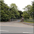
Disused entrance near Aberbargoed
Viewed across the A4049 Pengam Road.
Clues as to the previous use of the now empty site are two notices on the wall :
CAUTION CHILDREN and NO UNAUTHORISED VEHICLES BEYOND THIS POINT.
Image: © Jaggery
Taken: 4 Jul 2013
0.11 miles
5
Gwaelodywaun Villas, Aberbargoed
Viewed across the A4049 Pengam Road. The houses are opposite St Margaret's Business Park.
Image: © Jaggery
Taken: 4 Jul 2013
0.14 miles
6
Angel Lane Industrial Estate, Aberbargoed
Viewed from the access road from the A4049.
Image: © Jaggery
Taken: 4 Jul 2013
0.15 miles
7
Northern boundary of Britannia
The A4049 Pengam Road from Aberbargoed reaches the boundary sign for Britannia,
a hamlet in Caerphilly County Borough.
Image: © Jaggery
Taken: 4 Jul 2013
0.16 miles
8
Aberbargoed Community Fire and Rescue Station
A new fire station to the south of Aberbargoed is nearing completion.
It will eventually replace the existing fire stations in Cefn Forest http://www.geograph.org.uk/photo/467196 and Bargoed http://www.geograph.org.uk/photo/467177 .
Image: © Robin Drayton
Taken: 23 Jan 2014
0.17 miles
9
Work progressing on the new Aberbargoed Community Fire and Rescue Station
This is an early July 2013 view of the Knox & Wells building site on the corner of the A4049 and the connecting road to the A469. The fire station being built here is scheduled to open in January 2014.
The fire stations in Cefn Fforest and Bargoed will then close.
Image: © Jaggery
Taken: 4 Jul 2013
0.18 miles
10
Aberbargoed Fire Station
The station is just outside Bargoed Woodland Park, foreground, and on a link road between two A roads.
Image: © M J Roscoe
Taken: 16 Mar 2021
0.20 miles


