1
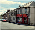
Family Choice Bargains, Aberbargoed
The shop at 52 Commercial Street, on the corner of Heol-y-felin, was formerly Midway Stores.
Image: © Jaggery
Taken: 1 Jun 2013
0.01 miles
2
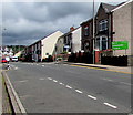
Commercial Street, Aberbargoed
Part of the west side of Commercial Street viewed from the War Memorial Gates. http://www.geograph.org.uk/photo/3541224
Image: © Jaggery
Taken: 4 Jul 2013
0.01 miles
3
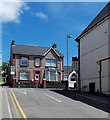
Family Choice Bargains, 52 Commercial Street, Aberbargoed
Convenience store on the corner of Heol-y-felin. In June 2019 text on the nameboard shows
OFF LICENCE - TOP UPS - GROCERIES - NEWSAGENT - TOBACCO.
Image: © Jaggery
Taken: 5 Jun 2019
0.01 miles
4
Ordnance Survey Cut Mark
This OS cut mark can be found on the wall of the old Institute on Commercial Road. It marks a point 80.435m above mean sea level.
Image: © Adrian Dust
Taken: 12 Feb 2021
0.01 miles
5
NW along Commercial Street, Aberbargoed
Looking to the northwest along the A4049 Commercial Street.
The white-on-green Hills Community Church name sign is on the right.
Image: © Jaggery
Taken: 5 Jun 2019
0.01 miles
6
Brindavan Care Home, Aberbargoed
The privately owned care home is in Commercial Street.
Image: © Jaggery
Taken: 4 Jul 2013
0.01 miles
7
Cambrian One Stop Motor Cycles shop in Aberbargoed
Located in the Old Substation Building at 66 Commercial Street alongside the A4049.
Image: © Jaggery
Taken: 5 Jun 2019
0.02 miles
8
Hill View Care Home, Aberbargoed
Residential care home viewed across the A4049 Commercial Street.
Image: © Jaggery
Taken: 5 Jun 2019
0.02 miles
9
End of the 20mph zone along Heol-y-felin Aberbargoed
The 20mph speed limit in the vicinity of the village primary school http://www.geograph.org.uk/photo/3496309 increases to 30mph along Commercial Street ahead, though it reduces to 20mph again along Pant Street ahead on the left.
Image: © Jaggery
Taken: 1 Jun 2013
0.02 miles
10
Hills Community Church, Aberbargoed
The church is set back 20 metres from the Commercial Street roadway.
Image: © Jaggery
Taken: 4 Jul 2013
0.02 miles


