
IMAGES TAKEN NEAR TO
McDonnell Road, BARGOED, CF81 8UD
Introduction
This page details the photographs taken nearby to McDonnell Road, CF81 8UD by members of the Geograph project.
The Geograph project started in 2005 with the aim of publishing, organising and preserving representative images for every square kilometre of Great Britain, Ireland and the Isle of Man.

There are currently over 7.5m images from over14,400 individuals and you can help contribute to the project by visiting https://www.geograph.org.uk
Image Map
Images are licensed for reuse under creativecommons.org/licenses/by-sa/2.0
Notes
- Clicking on the map will re-center to the selected point.
- The higher the marker number, the further away the image location is from the centre of the postcode.
Image Listing (259 Images Found)
Images are licensed for reuse under creativecommons.org/licenses/by-sa/2.0
Image
Details
Distance
1
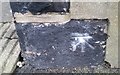
Ordnance Survey Cut Mark
This OS cut mark can be found on No14 Gwladys Avenue. It marks a point 232.812m above mean sea level.
Image: © Adrian Dust
Taken: 31 Aug 2019
0.07 miles
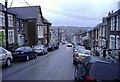
3
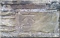
Ordnance Survey Cut Mark
This OS cut mark can be found on the wall of No13 Baldwin Street. It marks a point 227.990m above mean sea level.
Image: © Adrian Dust
Taken: 31 Aug 2019
0.07 miles
4
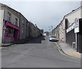
Heolddu Road, Bargoed
Viewed from the corner of Church Place and Upper High Street.
Image: © Jaggery
Taken: 19 Apr 2013
0.10 miles
5
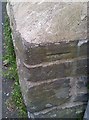
Ordnance Survey Cut Mark
This OS cut mark can be found on the wall of the old vicarage, Moorland Road. It marks a point 239.140m above mean sea level.
Image: © Adrian Dust
Taken: 31 Aug 2019
0.11 miles
6
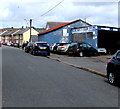
Park Road Garage, Bargoed
The Ruth Street side of the garage on the corner of Park Road.
Image: © Jaggery
Taken: 25 Apr 2018
0.12 miles
7
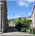
Back lane on the west side of Church Place, Bargoed
Ascending to North Road.
Image: © Jaggery
Taken: 21 Jun 2018
0.12 miles
8
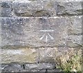
Ordnance Survey Cut Mark
This OS cut mark can be found on the old school wall, Llancayo Street. It marks a point 231.935m above mean sea level.
Image: © Adrian Dust
Taken: 31 Aug 2019
0.12 miles
9
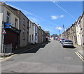
Heolddu Road, Bargoed
Ascending westwards from the Upper High Street/Francis Street/Church Place crossroads.
The two-way traffic sign faces one-way Upper High Street.
Image: © Jaggery
Taken: 21 Jun 2018
0.13 miles
10
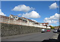
Llancayo Street, Bargoed
According to OS maps, a school is to be found on the wall behind the railings, but it obviously been replaced by houses more recently. That school was Bargod North Secondary Boys School (with thanks to Stephen Wilks for the information).
Image: © Gareth James
Taken: 17 Apr 2016
0.14 miles