
IMAGES TAKEN NEAR TO
Usk Road, BARGOED, CF81 8RL
Introduction
This page details the photographs taken nearby to Usk Road, CF81 8RL by members of the Geograph project.
The Geograph project started in 2005 with the aim of publishing, organising and preserving representative images for every square kilometre of Great Britain, Ireland and the Isle of Man.

There are currently over 7.5m images from over14,400 individuals and you can help contribute to the project by visiting https://www.geograph.org.uk
Image Map
Images are licensed for reuse under creativecommons.org/licenses/by-sa/2.0
Notes
- Clicking on the map will re-center to the selected point.
- The higher the marker number, the further away the image location is from the centre of the postcode.
Image Listing (251 Images Found)
Images are licensed for reuse under creativecommons.org/licenses/by-sa/2.0
Image
Details
Distance
1
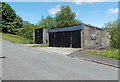
Usk Road lockup garages, Bargoed
Located near the northern end of Usk Road. In British usage, a street named Road may indicate the road to... but more often, as here, is only a street name. This Usk Road is about 300 metres long, extending from Church Street to the edge of smallholdings, many miles from the town of Usk or the River Usk.
The nearby river is the Rhymney.
Image: © Jaggery
Taken: 1 Jun 2013
0.01 miles
2
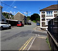
Towards the northwest end of Usk Road, Bargoed
Looking past the Graig Terrace junction https://www.geograph.org.uk/photo/5822541 on the right.
Image: © Jaggery
Taken: 21 Jun 2018
0.03 miles
3
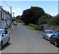
Northwest end of Usk Road, Bargoed
Usk Road northwest of the Hill Street and Graig Terrace junctions.
Image: © Jaggery
Taken: 21 Jun 2018
0.03 miles
4
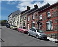
Graig Terrace houses, Bargoed
Viewed from the Bristol Terrace end looking up towards Usk Road. The houses face the south side of this http://www.geograph.org.uk/photo/3491762 church. There are no gradient signs here. I estimate that Graig Terrace ascends 14 metres in 70 metres, for a 1 in 5 or 20% gradient.
Image: © Jaggery
Taken: 1 Jun 2013
0.03 miles
5
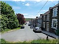
Down Usk Road, Bargoed
Usk Road descends to the SE away from an area of smallholdings behind the camera.
Image: © Jaggery
Taken: 1 Jun 2013
0.03 miles
6
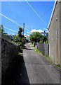
Steep side road in Bargoed
Ascending from Usk Road to Upper North Road.
Image: © Jaggery
Taken: 21 Jun 2018
0.03 miles
7
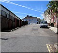
Steep ascent, Graig Terrace, Bargoed
Up Graig Terrace towards Usk Road.
Image: © Jaggery
Taken: 21 Jun 2018
0.04 miles
8
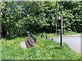
Bench, litter bin and signpost at the NW end of Usk Road, Bargoed
The bench has its back to Usk Road. The wooden sign points along a track.
Image: © Jaggery
Taken: 1 Jun 2013
0.04 miles
9
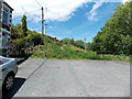
NW end of Usk Road, Bargoed
300 metres NW of its southern end at Church Street, Usk Road ends at a track through an area marked on maps as smallholdings.
Image: © Jaggery
Taken: 1 Jun 2013
0.04 miles
10
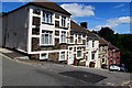
Graig Terrace houses, Bargoed
On the left here https://www.geograph.org.uk/photo/5822541 viewed from the corner of Usk Road.
Image: © Jaggery
Taken: 21 Jun 2018
0.05 miles