
IMAGES TAKEN NEAR TO
Cardiff Road, BARGOED, CF81 8NN
Introduction
This page details the photographs taken nearby to Cardiff Road, CF81 8NN by members of the Geograph project.
The Geograph project started in 2005 with the aim of publishing, organising and preserving representative images for every square kilometre of Great Britain, Ireland and the Isle of Man.

There are currently over 7.5m images from over14,400 individuals and you can help contribute to the project by visiting https://www.geograph.org.uk
Image Map
Images are licensed for reuse under creativecommons.org/licenses/by-sa/2.0
Notes
- Clicking on the map will re-center to the selected point.
- The higher the marker number, the further away the image location is from the centre of the postcode.
Image Listing (160 Images Found)
Images are licensed for reuse under creativecommons.org/licenses/by-sa/2.0
Image
Details
Distance
1
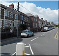
Cardiff Road, Bargoed
Cardiff Road heads NW away from Park Place at the Gilfach/Bargoed boundary. http://www.geograph.org.uk/photo/3463912
Image: © Jaggery
Taken: 15 May 2013
0.02 miles
2
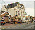
Parc Hotel and Red'z Bar and Restaurant, Bargoed
9-room hotel, bar and restaurant (Chinese, Cantonese & English cuisine) located opposite the junction of Cardiff Road and Hillside Park.
Image: © Jaggery
Taken: 7 May 2010
0.03 miles
3
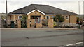
Bargoed Hall Family Health Centre
3-doctor health centre located on Cardiff Road, opposite the Hillside Park junction.
Image: © Jaggery
Taken: 7 May 2010
0.03 miles
4
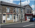
Jason's Bikes, Bargoed
Bicycle sales and repairs business at 53 Gilfach Street.
Image: © Jaggery
Taken: 15 May 2013
0.04 miles
5
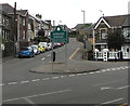
Junction of Cardiff Road and Park Place, Bargoed
Viewed from Gilfach. Cardiff Road ascends past the boundary sign which shows that Bargoed is Bargod in Welsh.
Image: © Jaggery
Taken: 1 May 2019
0.04 miles
6
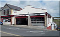
St David's Tyres, Bargoed
On the corner of Gilfach Street and Eastview Terrace.
Image: © Jaggery
Taken: 15 May 2013
0.05 miles
7
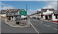
Southern boundary of Bargoed
The road from the village of Gilfach reaches the town of Bargoed. The boundary sign is located between Cardiff Road on the left and Park Place on the right. The Welsh name for the town is Bargod. It is strange that the English name is Bargoed, using an oe formation rare in English. Perhaps the spelling arose because of the analogy of nearby Hengoed (meaning old wood).
Image: © Jaggery
Taken: 15 May 2013
0.05 miles
8
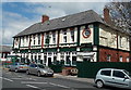
The Capel, Gilfach
The large pub and bed & breakfast is located on Park Place at the northern edge of Gilfach.
The boundary sign at the southern edge of Bargoed is a few metres away. http://www.geograph.org.uk/photo/3463912
Image: © Jaggery
Taken: 15 May 2013
0.05 miles
9
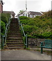
Steps up from Angel Lane, Gilfach
Ascending to Park Place on the right here. https://www.geograph.org.uk/photo/6143762
Image: © Jaggery
Taken: 1 May 2019
0.05 miles
10
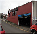
Bargoed Tyres, Brakes & Exhausts, Bargoed
Eastview Terrace side of the business at 55 Gilfach Street.
Image: © Jaggery
Taken: 1 May 2019
0.05 miles