IMAGES TAKEN NEAR TO
Brooklands, PONTYCLUN, CF72 9JQ
Introduction
This page details the photographs taken nearby to Brooklands, CF72 9JQ by members of the Geograph project.
The Geograph project started in 2005 with the aim of publishing, organising and preserving representative images for every square kilometre of Great Britain, Ireland and the Isle of Man.

There are currently over 7.5m images from over14,400 individuals and you can help contribute to the project by visiting https://www.geograph.org.uk
Image Map
Images are licensed for reuse under creativecommons.org/licenses/by-sa/2.0
Notes
- Clicking on the map will re-center to the selected point.
- The higher the marker number, the further away the image location is from the centre of the postcode.
Image Listing (47 Images Found)
Images are licensed for reuse under creativecommons.org/licenses/by-sa/2.0
Image
Details
Distance
1
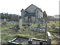
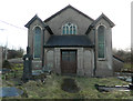
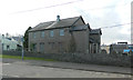
Peniel Chapel and burial ground, Llanharry
Image: © John Lord
Taken: 19 Jan 2018
0.01 miles
4
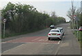
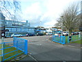
From 20 to 30, Llanharry
Near the SW edge of the village, the 20mph speed limit in force near schools increases to 30mph. In the background, the road crosses a bridge over the M4 motorway.
Image: © Jaggery
Taken: 21 Apr 2021
0.02 miles
5
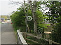
Public footpath direction sign at the southern edge of Llanharry
The white arrow on the green sign points towards this track https://www.geograph.org.uk/photo/6815451 near the north side of the M4 motorway.
Image: © Jaggery
Taken: 21 Apr 2021
0.03 miles
6
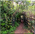
East along a track in the south of Llanharry
The white arrow on a public footpath direction sign https://www.geograph.org.uk/photo/6815449 points this way.
Image: © Jaggery
Taken: 21 Apr 2021
0.05 miles
7
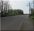
Road ascending from Llanharry towards Degar
Towards the bridge over the M4 motorway at the southern edge of Llanharry.
Image: © Jaggery
Taken: 21 Apr 2021
0.05 miles
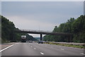
8
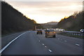
Rhondda Cynon Taf : M4 Motorway
The M4 Motorway heading through Rhondda Cynon Taf.
Image: © Lewis Clarke
Taken: 10 Apr 2014
0.05 miles