1
Cwrt Bethel, Pontyclun
Aelwyd Housing Association flats on the corner of Llantrisant Road and Lewis Street.
The name and corner location suggest it's likely that there used to be a Bethel chapel here.
In June 2014, the Bethel Baptist Centre is in a modern building nearby. http://www.geograph.org.uk/photo/4017284
Image: © Jaggery
Taken: 5 Jun 2014
0.02 miles
2
Llantrisant Road houses, Pontyclun
The A4222, here named Llantrisant Road, is the main road through Pontyclun. Pontyclun Funeral Services and Griffiths Memorials Monumental Masons http://www.geograph.org.uk/photo/4017375 are on the right, in Clun Avenue.
Image: © Jaggery
Taken: 5 Jun 2014
0.02 miles
3
Lewis St, Pontyclun
Image: © John Lord
Taken: 1 Dec 2017
0.03 miles
4
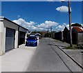
A back lane in Pontyclun
Looking north from Clun Avenue past lockup garages east of Llantrisant Road.
Image: © Jaggery
Taken: 5 Jun 2014
0.04 miles
5
Long wooden building in a back lane, Pontyclun
From a distance, this 18 metre long building looked liked it could be a scout hut or an Army Cadets hut. It wasn't either of these. The lane extends north from Clun Avenue towards St Paul's Church. http://www.geograph.org.uk/photo/4017275
Image: © Jaggery
Taken: 5 Jun 2014
0.04 miles
6
Pontyclun Funeral Services, Pontyclun
Viewed across Clun Avenue. The other name on the wall is Griffiths Memorials Monumental Masons.
Image: © Jaggery
Taken: 5 Jun 2014
0.06 miles
7
Barking Basement in Pontyclun
The banner on the wall outside 71 Llantrisant Road shows Barking Basement Dog Grooming Studio.
Image: © Jaggery
Taken: 5 Jun 2014
0.06 miles
8
Merthyr Street bungalows, Pontyclun
The Maelog Close junction is a few metres beyond the bungalow on the left.
Image: © Jaggery
Taken: 5 Jun 2014
0.06 miles
9
St Paul's Church, Pontyclun
Image: © John Lord
Taken: 1 Dec 2017
0.06 miles
10
Merthyr Street, Pontyclun
Viewed across the A4222 Llantrisant Road.
At the far end of Merthyr Street is Maelog Close, on a bank of the Ely River.
Image: © Jaggery
Taken: 5 Jun 2014
0.06 miles


