
IMAGES TAKEN NEAR TO
Tredegar Avenue, PONTYCLUN, CF72 9BW
Introduction
This page details the photographs taken nearby to Tredegar Avenue, CF72 9BW by members of the Geograph project.
The Geograph project started in 2005 with the aim of publishing, organising and preserving representative images for every square kilometre of Great Britain, Ireland and the Isle of Man.

There are currently over 7.5m images from over14,400 individuals and you can help contribute to the project by visiting https://www.geograph.org.uk
Image Map
Images are licensed for reuse under creativecommons.org/licenses/by-sa/2.0
Notes
- Clicking on the map will re-center to the selected point.
- The higher the marker number, the further away the image location is from the centre of the postcode.
Image Listing (98 Images Found)
Images are licensed for reuse under creativecommons.org/licenses/by-sa/2.0
Image
Details
Distance
1
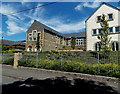
Large H-shaped building in Llanharan
Located between Chapel Road (on this side) and Brook Terrace.
I saw no name signs to indicate its current or previous usage.
UPDATE A correspondent states that this building used to be Llanharan Primary School.
Image: © Jaggery
Taken: 19 Jun 2014
0.00 miles
2
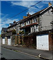
Chapel Road houses, Llanharan
Chapel Road here passes along a ledge on a slope. The houses are set above road level. Beyond the left edge of the view, hedges and trees line the south side of the road, at the edge of a slope down to the South Wales main railway line near Llanharan station.
Image: © Jaggery
Taken: 19 Jun 2014
0.02 miles
3
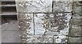
Ordnance Survey Cut Mark
This OS cut mark can be found on the school gatepost NE side of Chapel Road. It marks a point 72.225m above mean sea level.
Image: © Adrian Dust
Taken: 28 Apr 2018
0.02 miles
4
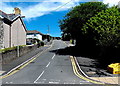
Southern end of Tredegar Avenue, Llanharan
From Chapel Road.
Image: © Jaggery
Taken: 19 Jun 2014
0.03 miles
5
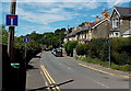
Trio of No Through Road signs in Llanharan
Alongside Church Road at the Tredegar Avenue junction, http://www.geograph.org.uk/photo/4034916 on the approach to Chapel Hill.
Perhaps there are two signs on the left because the one on the right is liable to have the hedge grow around it.
Image: © Jaggery
Taken: 19 Jun 2014
0.04 miles
6
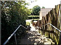
Steps down to Bethlehem View, Llanharan
From Chapel Road, opposite the Tredegar Avenue junction.
Image: © Jaggery
Taken: 19 Jun 2014
0.04 miles
7
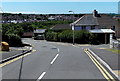
Northern end of Tredegar Avenue, Llanharan
Tredegar Avenue descends from Hillside Avenue past the Park Terrace junction on the right.
Image: © Jaggery
Taken: 19 Jun 2014
0.05 miles
8
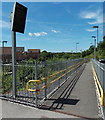
Down a ramp towards platform 1 at Llanharan railway station
Access on this side of the station is via ramps or steps. http://www.geograph.org.uk/photo/4462638
Image: © Jaggery
Taken: 19 Jun 2014
0.06 miles
9
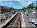
West through Llanharan railway station
Viewed from the station footbridge. Access to and from platform 2 on the left is on flat ground.
On the steeper ground on the right, access to and from platform 1 is via either steps or ramps.
Image: © Jaggery
Taken: 19 Jun 2014
0.06 miles
10
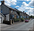
Row of houses, Chapel Road, Llanharan
Viewed from the Chapel Hill end looking ESE.
Image: © Jaggery
Taken: 19 Jun 2014
0.07 miles