1
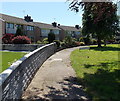
Pontyclun Library
Located in Heol y Felin, part of the Rhondda Cynon Taf library service. The modernised, extended library has eight public access computers, a colourful children's area, a dedicated teenage area and community meeting room. It is a WiFi hotspot.
Image: © Jaggery
Taken: 5 Jun 2014
0.03 miles
2
Pontyclun Primary School
Viewed from Heol y Felin, near Pontyclun Library. A large notice under the school name sign requests all visitors and deliveries to report to the school office through the main entrance off Palalwyf Avenue.
Image: © Jaggery
Taken: 5 Jun 2014
0.04 miles
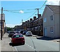
3
Maesyfelin Crescent, Pontyclun
On the south side of the A4222 Cowbridge Road.
Image: © Jaggery
Taken: 5 Jun 2014
0.06 miles
4
Pontyclun War Memorial
Located alongside the A4222 Cowbridge Road.
Image: © Jaggery
Taken: 5 Jun 2014
0.09 miles
5
Palalwyf Avenue, Pontyclun
Looking SE from the Cowbridge Road end. I didn't recall ever seeing any other street named Palalwyf (Welsh for lime tree). One online source states that this is the only instance of an avenue (or road, street, close etc) with this name in the UK.
Image: © Jaggery
Taken: 5 Jun 2014
0.09 miles
6
Pontyclun Masonic Hall
There is no name on this building on the corner of Park Crescent and the A4222 Cowbridge Road.
The silver Star of David on the side wall indicated that this could be a Jewish synagogue, but the presence of another symbol above the entrance showed that this is a Masonic Hall, confirmed by several online references.
Image: © Jaggery
Taken: 5 Jun 2014
0.09 miles
7
Castan Road towards Palalwyf Avenue, Pontyclun
Looking SW from Cerdin Avenue near Hope Penuel Presbyterian Church. http://www.geograph.org.uk/photo/4014191
Image: © Jaggery
Taken: 5 Jun 2014
0.09 miles
8
Zeera, Pontyclun
Behind a bus stop, Zeera Indian cuisine takeaway is at 51 Cowbridge Road.
Also in view are The Flower Pot on the left, on the corner of Palalwyf Avenue,
and Scissors Pontyclun hair salon on the right.
Image: © Jaggery
Taken: 5 Jun 2014
0.10 miles
9
Long row of houses, Cowbridge Road, Pontyclun
The row extends for 90 metres, from the corner of Heol y Felin on this side,
to the corner of Palalwyf Avenue. Turn right here for the library. http://www.geograph.org.uk/photo/4013771
Image: © Jaggery
Taken: 5 Jun 2014
0.10 miles
10
You shop, we drop in Pontyclun
The slogan is on the side of a Tesco lorry from which stock is being unloaded
to replenish the Tesco Express store in Cowbridge Road.
Image: © Jaggery
Taken: 5 Jun 2014
0.10 miles


