Pontyclun Masonic Hall
Introduction
The photograph on this page of Pontyclun Masonic Hall by Jaggery as part of the Geograph project.
The Geograph project started in 2005 with the aim of publishing, organising and preserving representative images for every square kilometre of Great Britain, Ireland and the Isle of Man.

There are currently over 7.5m images from over 14,400 individuals and you can help contribute to the project by visiting https://www.geograph.org.uk
Pontyclun Masonic Hall
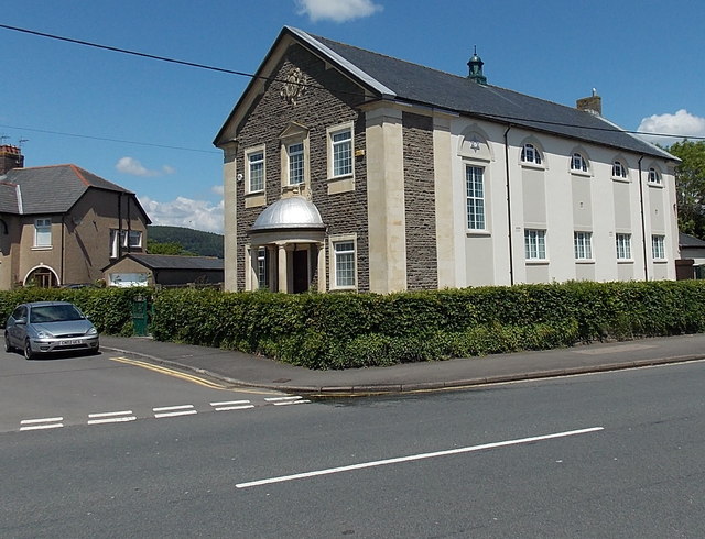
Image: © Jaggery Taken: 5 Jun 2014
There is no name on this building on the corner of Park Crescent and the A4222 Cowbridge Road. The silver Star of David on the side wall indicated that this could be a Jewish synagogue, but the presence of another symbol above the entrance showed that this is a Masonic Hall, confirmed by several online references.
Images are licensed for reuse under creativecommons.org/licenses/by-sa/2.0
Image Location
Latitude
51.521516
Longitude
-3.393858