1
Sign and footbridge to footpath to Rhiwfelin Fach Farm
Image: © John Lord
Taken: 25 Nov 2017
0.06 miles
2
Recycling centre, Llantrisant
Entrance to the recycling centre at Llantrisant.
Image: © Alan Hughes
Taken: 5 Nov 2018
0.06 miles
3
The Nant Muchudd
Image: © John Lord
Taken: 25 Nov 2017
0.11 miles
4
North along Pantybrad, Llantrisant
Pantybrad crosses the brook Nant Muchudd near the small group of people in the middle distance.
The northeast edge of the Royal Mint site is in the background.
The Bird Transport site is on the right. http://www.geograph.org.uk/photo/5432118
Image: © Jaggery
Taken: 17 Jun 2017
0.13 miles
5
Bird Transport, Llantrisant Business Park, Llantrisant
Premises of C.J.Bird Transport Limited viewed across the road named Pantybrad.
Image: © Jaggery
Taken: 17 Jun 2017
0.17 miles
6
Car park entrance
Entrance to the car park at the Royal Mint, Llantrisant.
Image: © Alan Hughes
Taken: 24 Mar 2019
0.19 miles
7
Royal Mint car and coach park entrance, Llantrisant
On the south side of the road named Pantybrad.
Image: © Jaggery
Taken: 17 Jun 2017
0.20 miles
8
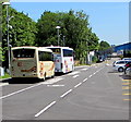
Coaches in the Royal Mint car and coach park, Llantrisant
On the left here. http://www.geograph.org.uk/photo/5447506
Image: © Jaggery
Taken: 17 Jun 2017
0.20 miles
9
Royal Mint car and coach park, Llantrisant
At the southeast edge of the Royal Mint site, the car park occupies a triangular site
between roads named Heol-y-Sarn and Pantybrad and a brook named Nant Muchudd.
Image: © Jaggery
Taken: 17 Jun 2017
0.20 miles
10
Footpath at rear of Royal Mint Experience
Enclosed path used by tour visitors returning from factory, left, to Experience exhibitions and shop, right.
Image: © M J Roscoe
Taken: 28 Jul 2017
0.21 miles


