IMAGES TAKEN NEAR TO
Walnut Close, PONTYCLUN, CF72 8RZ

Introduction

This page details the photographs taken nearby to Walnut Close, CF72 8RZ by members of the Geograph project.

The Geograph project started in 2005 with the aim of publishing, organising and preserving representative images for every square kilometre of Great Britain, Ireland and the Isle of Man.

There are currently over 7.5m images from over14,400 individuals and you can help contribute to the project by visiting https://www.geograph.org.uk

Image Map


Images are licensed for reuse under creativecommons.org/licenses/by-sa/2.0
Notes
  • Clicking on the map will re-center to the selected point.
  • The higher the marker number, the further away the image location is from the centre of the postcode.

Image Listing (18 Images Found)

Images are licensed for reuse under creativecommons.org/licenses/by-sa/2.0
Image
Details
Distance
1
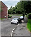
Parc Ifor Hen, Miskin
Cul-de-sac on the southwest side of Ffordd Cefn-yr-Hendy.
Image: © Jaggery Taken: 29 Aug 2017
0.15 miles
2
Junction of Cardiff Road and Ffordd Cefn-yr-Hendy, Miskin
Cardiff Road from the right joins Ffordd Cefn-yr-Hendy.
Image: © Jaggery Taken: 29 Aug 2017
0.15 miles
3
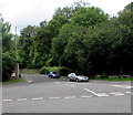
Junction of Ffordd Cefn-yr-Hendy and Parc Ifor Hen, Miskin
The cars are parked in Parc Ifor Hen.
Image: © Jaggery Taken: 29 Aug 2017
0.15 miles
4
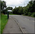
Ffordd Cefn-yr-Hendy bus stop and shelter, Miskin
This stop is for buses to central Cardiff via Groesfaen and Llandaff.
Image: © Jaggery Taken: 29 Aug 2017
0.16 miles
5
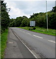
Up Ffordd Cefn-yr-Hendy, Miskin
Ffordd Cefn-yr-Hendy ascends northwards away from the B4264.
Image: © Jaggery Taken: 29 Aug 2017
0.17 miles
6
Down Ffordd Cefn-yr-Hendy, Miskin
Ffordd Cefn-yr-Hendy descends towards the roundabout at the B4264 junction.
Image: © Jaggery Taken: 29 Aug 2017
0.18 miles
7
Roundabout near Miskin
Image: © John Lord Taken: 1 Dec 2017
0.20 miles
8
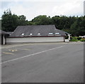
All Hallows Parish Centre, Miskin
Church hall on the northeast side of this http://www.geograph.org.uk/photo/5518469 Roman Catholic church.
Image: © Jaggery Taken: 29 Aug 2017
0.20 miles
9
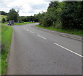
Cardiff Road from Mwyndy towards Miskin
The Miskin boundary sign http://www.geograph.org.uk/photo/5517647 is just out of shot ahead.
Image: © Jaggery Taken: 29 Aug 2017
0.20 miles
10
Miskin/Meisgyn boundary sign
The bilingual sign alongside Cardiff Road faces the hamlet of Mwyndy at the NE edge of Miskin (Meisgyn in Welsh).
Image: © Jaggery Taken: 29 Aug 2017
0.20 miles