1
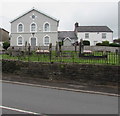
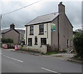
Y Parc, Groesfaen
Image: © John Lord
Taken: 4 Nov 2017
0.01 miles
2
Babell Methodist Chapel, Groesfaen
On the north side of the A4119. The Coflein website records that Babell Methodist
Chapel was built in 1866 in the Subclassical style of the gable-entry type.
Image: © Jaggery
Taken: 29 Aug 2017
0.04 miles
3
Babel Chapel, Groesfaen
Babel appears to be the name by which the chapel is currently known, e.g. on the bus-stop near it, and the bus time-table. This surprising name for a place of worship (in the Book of Genesis the tower of Babel came under God's judgment as expressing man's rebellion against God) is a corruption of the Welsh word Babell, meaning a tent, presumably a reference to the Tabernacle, Israel's place of worship. Babell was originally a Welsh Calvinistic Methodist chapel, but is now used by the Plymouth Brethren Christian Church.
Image: © John Lord
Taken: 4 Nov 2017
0.05 miles
4
Babell Chapel
You will find this Presbyterian Church Of Wales Chapel set back on the north side of the A119 in the centre of Goes - Faen.
Image: © Peter Wasp
Taken: 4 Apr 2007
0.05 miles
5
Babel Chapel, Groesfaen
Babel appears to be the name by which the chapel is currently known, e.g. on the bus-stop near it, and the bus time-table. This surprising name for a place of worship (in the book of Genesis the tower of Babel came under God's judgment as expressing man's rebellion against God) is a corruption of the Welsh word Babell, meaning a tent, presumably a reference to the Tabernacle, Israel's place of worship. Babell was originally a Welsh Calvinistic Methodist chapel, but is now used by the Plymouth Brethren Christian Church.
Image: © John Lord
Taken: 4 Nov 2017
0.05 miles
6
Y Parc, Groesfaen
The road named Y Parc ascends from the A4119 towards Park Lane.
Image: © Jaggery
Taken: 29 Aug 2017
0.06 miles
7
Llantrisant Road houses, Groesfaen
On the north side of the A4119 Llantrisant Road.
Image: © Jaggery
Taken: 29 Aug 2017
0.06 miles
8
Groes-faen
A4119 Llantrisant Road running through Groes-faen.
Image: © Chris Hodcroft
Taken: 14 Apr 2007
0.06 miles
9
A4119 looking east at Groes-faen
Image: © Colin Pyle
Taken: 9 Sep 2011
0.06 miles
10
Dan-y-bryn Farm, Groesfaen
The name on the house is DAN-Y-BRYN FARM. The white arrow on the green notice on the wall
points to the village shop car park. The village shop http://www.geograph.org.uk/photo/5516792 is set back from the left side of the house.
Image: © Jaggery
Taken: 29 Aug 2017
0.07 miles


