
IMAGES TAKEN NEAR TO
Heol Las, PONTYCLUN, CF72 8EJ
Introduction
This page details the photographs taken nearby to Heol Las, CF72 8EJ by members of the Geograph project.
The Geograph project started in 2005 with the aim of publishing, organising and preserving representative images for every square kilometre of Great Britain, Ireland and the Isle of Man.

There are currently over 7.5m images from over14,400 individuals and you can help contribute to the project by visiting https://www.geograph.org.uk
Image Map
Images are licensed for reuse under creativecommons.org/licenses/by-sa/2.0
Notes
- Clicking on the map will re-center to the selected point.
- The higher the marker number, the further away the image location is from the centre of the postcode.
Image Listing (38 Images Found)
Images are licensed for reuse under creativecommons.org/licenses/by-sa/2.0
Image
Details
Distance
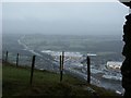
2
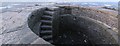
On top of Billy Wynt
The top of the small folly is flat enough to walk on. The stapled flag stones are covered in carved graffiti. Having been built so long ago, safety features are in short supply. The narrow staircase has some mounting points for a long gone handrail.
Image: © Nigel Davies
Taken: 6 Feb 2010
0.14 miles
3
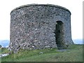
Billy Wynt
Opinions vary as to whether this was the location of a windmill or a fortification. Either way the original damaged structure has been rebuilt as a folly.
The hilltop location provides quite a view.
Image: © Nigel Davies
Taken: 6 Feb 2010
0.14 miles
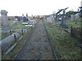
5
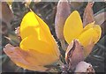
Gorse flower
Ulex Europaeus - the European gorse.
Image: © Alan Hughes
Taken: 18 Nov 2019
0.15 miles
8
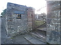
Entrance to Penuel Cemetery, Llantrisant
The plaque above the name-plate records the presence of American troops on the nearby Llantrisant Common during WWII.
Image: © John Lord
Taken: 25 Nov 2017
0.17 miles
9
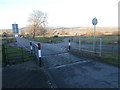
Cattle grid from Llantrisant on to Llantrisant Common
Image: © John Lord
Taken: 25 Nov 2017
0.17 miles
10
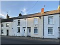
Swan Street
Four cottages in Swan Street, Llantrisant. One of Glamorgan’s first workhouses was established in these four houses in 1784.
See also Image
Image: © Alan Hughes
Taken: 18 Nov 2019
0.17 miles