
IMAGES TAKEN NEAR TO
CF71 7GL
Introduction
This page details the photographs taken nearby to CF71 7GL by members of the Geograph project.
The Geograph project started in 2005 with the aim of publishing, organising and preserving representative images for every square kilometre of Great Britain, Ireland and the Isle of Man.

There are currently over 7.5m images from over14,400 individuals and you can help contribute to the project by visiting https://www.geograph.org.uk
Image Map
Images are licensed for reuse under creativecommons.org/licenses/by-sa/2.0
Notes
- Clicking on the map will re-center to the selected point.
- The higher the marker number, the further away the image location is from the centre of the postcode.
Image Listing (71 Images Found)
Images are licensed for reuse under creativecommons.org/licenses/by-sa/2.0
Image
Details
Distance
1
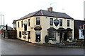
Trio Brasserie, Cowbridge
Located in eastern Cowbridge at the crossroads of Cardiff Road, Aberthin Road, Eastgate and St Athan Road. The Shorter Oxford English Dictionary defines brasserie as
"A (French) saloon selling beer and usually food; generally, an informal restaurant."
The second definition applies here.
Image: © Jaggery
Taken: 19 Jan 2012
0.04 miles
2
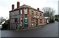
Edmondes Arms, Jack's Corner, Cowbridge
Pub on the corner of Cardiff Road and Aberthin Road. Both roads are the A4222 which makes a 90 degree turn here.
The name Jack’s Corner on the building recalls a dog that once lived here. The year on the pub name sign is 1899, but there is a reference to The Edmondes Arms Public House in an 1895 edition of a Kelly's Directory, so presumably the current building was built on the site of its predecessor. The Directory records that a Mrs Edmondes of High Street is a "principal landowner" in Cowbridge.
Image: © Jaggery
Taken: 19 Jan 2012
0.04 miles
3
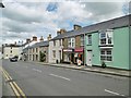
Cowbridge Post Office
Post office and store on Eastgate.
Image: © Mike Faherty
Taken: 12 Jul 2016
0.04 miles
4
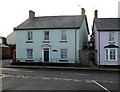
Eastgate Mews, Cowbridge
House on the corner of Eastgate and Croft Terrace, viewed from Druids Green.
The red phonebox on the left, dating from c1950, was Grade II listed in November 1992.
Image: © Jaggery
Taken: 19 Jan 2012
0.05 miles
5
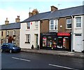
Select Convenience, Cowbridge
Convenience store at 27 Eastgate.
Image: © Jaggery
Taken: 19 Jan 2012
0.05 miles
6
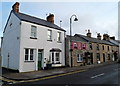
Eastgate houses, Cowbridge
Looking SE along Eastgate from near the corner of Druids Green. The corner house is Glen Cottage.
Image: © Jaggery
Taken: 19 Jan 2012
0.05 miles
7
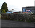
Old-style enamel advertising signs, Cowbridge
Survivors from a bygone age are these signs on the side of a building in Druids Green, near the fire station. http://www.geograph.org.uk/photo/2770973 One sign invites you to smoke 'Ogden's "Guinea-Gold" cigarettes, extra quality'
Another states "Use Feathery Flake the quality self raising flour".
The top edge of a Craven "A" (cigarettes) sign can also be seen.
Image: © Jaggery
Taken: 19 Jan 2012
0.05 miles
8
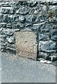
Old Milestone by the A4222, Eastgate, Cowbridge
Stone post by the A4222, in parish of Cowbridge with Llanblethian (Vale of Glamorgan District), Eastgate, Cowbridge, at junction with Aberthin Road, set in angled wall.
Inscription indistinct.
Surveyed
Milestone Society National ID: GLA_CFBE12
Image: © Milestone Society
Taken: Unknown
0.05 miles
9
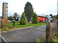
Tower, Cowbridge Fire Station
The training tower is in the northern corner of the fire station. http://www.geograph.org.uk/photo/2770973
Image: © Jaggery
Taken: 19 Jan 2012
0.05 miles
10
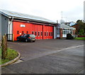
Cowbridge Fire Station
Located in Druids Green, Cowbridge, the station is part of the South Wales Fire and Rescue Service.
In addition to Cowbridge, the station covers the surrounding villages, such as Llanblethian, Colwinston, St Mary Church, Llandow, Aberthin and St Hilary, giving a residential population of c9000. Much of the c34 square miles covered by the station is farmland.
Image: © Jaggery
Taken: 19 Jan 2012
0.05 miles