
IMAGES TAKEN NEAR TO
Slade Close, COWBRIDGE, CF71 7BS
Introduction
This page details the photographs taken nearby to Slade Close, CF71 7BS by members of the Geograph project.
The Geograph project started in 2005 with the aim of publishing, organising and preserving representative images for every square kilometre of Great Britain, Ireland and the Isle of Man.

There are currently over 7.5m images from over14,400 individuals and you can help contribute to the project by visiting https://www.geograph.org.uk
Image Map
Images are licensed for reuse under creativecommons.org/licenses/by-sa/2.0
Notes
- Clicking on the map will re-center to the selected point.
- The higher the marker number, the further away the image location is from the centre of the postcode.
Image Listing (53 Images Found)
Images are licensed for reuse under creativecommons.org/licenses/by-sa/2.0
Image
Details
Distance
1

Cowbridge Fire Station
Cowbridge Fire Station, Druids Green, Eastgate, Cowbridge is part of South Wales Fire & Rescue Service
Image: © Kevin Hale
Taken: 5 Jun 2007
0.04 miles
2
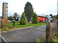
Tower, Cowbridge Fire Station
The training tower is in the northern corner of the fire station. http://www.geograph.org.uk/photo/2770973
Image: © Jaggery
Taken: 19 Jan 2012
0.09 miles
3

Cowbridge Fire Station
Located in Druids Green, Cowbridge, the station is part of the South Wales Fire and Rescue Service.
In addition to Cowbridge, the station covers the surrounding villages, such as Llanblethian, Colwinston, St Mary Church, Llandow, Aberthin and St Hilary, giving a residential population of c9000. Much of the c34 square miles covered by the station is farmland.
Image: © Jaggery
Taken: 19 Jan 2012
0.09 miles
4
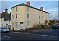
New Druids, Cowbridge
The 3-storey building at 41 Eastgate extends for 20 metres along Druids Green.
There was no sign on the building to indicate its usage, only the name sign New Druids.
Image: © Jaggery
Taken: 19 Jan 2012
0.09 miles
5
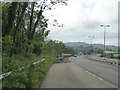
A48 westbound lay-by and bridge over A4222
Image: © David Smith
Taken: 1 Jun 2018
0.10 miles
6
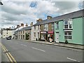
Cowbridge Post Office
Post office and store on Eastgate.
Image: © Mike Faherty
Taken: 12 Jul 2016
0.10 miles
7
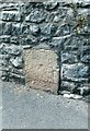
Old Milestone by the A4222, Eastgate, Cowbridge
Stone post by the A4222, in parish of Cowbridge with Llanblethian (Vale of Glamorgan District), Eastgate, Cowbridge, at junction with Aberthin Road, set in angled wall.
Inscription indistinct.
Surveyed
Milestone Society National ID: GLA_CFBE12
Image: © Milestone Society
Taken: Unknown
0.11 miles
8
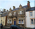
A late Victorian townhouse, Cowbridge
49 Eastgate was built in the 1890s.
Image: © Jaggery
Taken: 19 Jan 2012
0.12 miles
9

Morgan's Hair Design, Cowbridge
Located at 34 Eastgate, on the corner of Croft Street.
Image: © Jaggery
Taken: 19 Jan 2012
0.12 miles
10
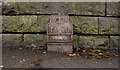
Bench Mark, Cowbridge
This bench mark is in the bus shelter against the remaining bridge parapet of the long closed Cowbridge and Aberthaw railway.
It is shown on the 1909 OS map but appears to be from George V or VI's era. Perhaps it is a replacement for an earlier one. The recorded elevation on the map is 101.3ft
Image: © Guy Butler-Madden
Taken: 23 Feb 2012
0.13 miles