
IMAGES TAKEN NEAR TO
Cherry Close, PENARTH, CF64 5BX
Introduction
This page details the photographs taken nearby to Cherry Close, CF64 5BX by members of the Geograph project.
The Geograph project started in 2005 with the aim of publishing, organising and preserving representative images for every square kilometre of Great Britain, Ireland and the Isle of Man.

There are currently over 7.5m images from over14,400 individuals and you can help contribute to the project by visiting https://www.geograph.org.uk
Image Map
Images are licensed for reuse under creativecommons.org/licenses/by-sa/2.0
Notes
- Clicking on the map will re-center to the selected point.
- The higher the marker number, the further away the image location is from the centre of the postcode.
Image Listing (45 Images Found)
Images are licensed for reuse under creativecommons.org/licenses/by-sa/2.0
Image
Details
Distance
1

Sunset over the Welsh coast
Viewed from Clevedon's Wain's Hill, the sun slips towards the Welsh coast around Barry and Penarth. The river is in serene mood this evening.
Image: © Neil Owen
Taken: 14 Aug 2022
0.06 miles
2
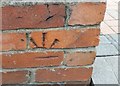
Ordnance Survey Cut Mark
This OS cut mark can be found on the wall of No210 Westbourne Road. It marks a point 17.297m above mean sea level.
Image: © Adrian Dust
Taken: 25 Sep 2017
0.06 miles
4
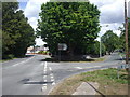
Junction of Lavernock Rd and Westbourne Rd, Penarth
Image: © John Lord
Taken: 6 Jul 2010
0.08 miles
6
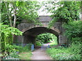
Forrest Road bridge, Penarth
Cycle path on the route of the former Cadoxton to Penarth railway line.
Image: © Gareth James
Taken: 9 Jun 2010
0.09 miles
7
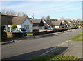
Caynham Avenue bungalows, Cosmeston
The west side of the avenue, viewed from the corner of Brockhill Rise.
Image: © Jaggery
Taken: 24 Nov 2010
0.09 miles
8
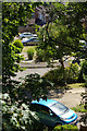
Rowan Close, Penarth
This is the view down from Forrest Road to where houses have taken over the trackbed of the Penarth - Cadoxton railway, closed in the late 1960s. Lower Penarth Halt was in this vicinity but it closed even earlier, in 1954.
Image: © Stephen McKay
Taken: 26 Jun 2018
0.11 miles
9
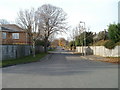
Forrest Road, Penarth
The view west from the edge of Cliff Walk.
Image: © Jaggery
Taken: 24 Nov 2010
0.11 miles
10
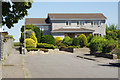
The Paddocks, Penarth
A large detached house backing on to the coast in the Lower Penarth area.
Image: © Stephen McKay
Taken: 26 Jun 2018
0.11 miles