
IMAGES TAKEN NEAR TO
Plymouth Road, PENARTH, CF64 3DB
Introduction
This page details the photographs taken nearby to Plymouth Road, CF64 3DB by members of the Geograph project.
The Geograph project started in 2005 with the aim of publishing, organising and preserving representative images for every square kilometre of Great Britain, Ireland and the Isle of Man.

There are currently over 7.5m images from over14,400 individuals and you can help contribute to the project by visiting https://www.geograph.org.uk
Image Map
Images are licensed for reuse under creativecommons.org/licenses/by-sa/2.0
Notes
- Clicking on the map will re-center to the selected point.
- The higher the marker number, the further away the image location is from the centre of the postcode.
Image Listing (256 Images Found)
Images are licensed for reuse under creativecommons.org/licenses/by-sa/2.0
Image
Details
Distance
1
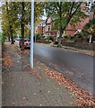
Plymouth Road trees, Penarth
Looking north along Plymouth Road from the corner of Archer Road.
Image: © Jaggery
Taken: 26 Oct 2021
0.01 miles
2
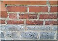
Ordnance Survey Cut Mark
This OS cut mark can be found on the wall of No44 Plymouth Road. It marks a point 38.466m above mean sea level.
Image: © Adrian Dust
Taken: 17 Sep 2021
0.03 miles
3
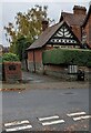
Western end of Tower Hill, Penarth
Viewed across Plymouth Road from Archer Road.
Tower Hill leads to Marine Parade.
Image: © Jaggery
Taken: 26 Oct 2021
0.03 miles
4
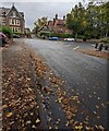
Fallen leaves, Archer Road, Penarth
Looking towards the Plymouth Road junction on October 26th 2021.
Image: © Jaggery
Taken: 26 Oct 2021
0.03 miles
5
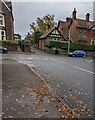
Eastern end of Archer Road, Penarth
Archer Road ends at the Plymouth Road junction.
Image: © Jaggery
Taken: 26 Oct 2021
0.03 miles
6
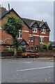
Eastern end of Sully Place, Penarth
Looking south from the corner of Archer Road and Plymouth Road.
Image: © Jaggery
Taken: 26 Oct 2021
0.05 miles
7
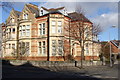
At the junction of Plymouth Road with Holmsdale Road
This building, which I take to be one or more private dwellings, is an example of the magnificent domestic architecture of Plymouth Road, which I am assuming to be late Victorian (but have not researched).
Image: © Ruth Sharville
Taken: 7 Feb 2009
0.05 miles
8
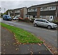
Vehicles and houses, Berkley Drive, Penarth
Viewed from the corner of Archer Road.
Image: © Jaggery
Taken: 26 Oct 2021
0.06 miles
9
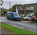
Kwik Fit van, Berkley Drive, Penarth
Parked in the background here https://www.geograph.org.uk/photo/7001749 in October 2021.
Image: © Jaggery
Taken: 26 Oct 2021
0.06 miles
10
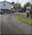
Bend in Berkley Drive, Penarth
On the approach to the Archer Road junction.
Image: © Jaggery
Taken: 5 Nov 2021
0.06 miles