
IMAGES TAKEN NEAR TO
Marine Parade, PENARTH, CF64 3BE
Introduction
This page details the photographs taken nearby to Marine Parade, CF64 3BE by members of the Geograph project.
The Geograph project started in 2005 with the aim of publishing, organising and preserving representative images for every square kilometre of Great Britain, Ireland and the Isle of Man.

There are currently over 7.5m images from over14,400 individuals and you can help contribute to the project by visiting https://www.geograph.org.uk
Image Map
Images are licensed for reuse under creativecommons.org/licenses/by-sa/2.0
Notes
- Clicking on the map will re-center to the selected point.
- The higher the marker number, the further away the image location is from the centre of the postcode.
Image Listing (155 Images Found)
Images are licensed for reuse under creativecommons.org/licenses/by-sa/2.0
Image
Details
Distance
1
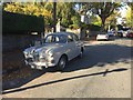
Marine Parade, Penarth
Car parked on Marine Parade, close to the junction with Park Road and Bridgeman Road.
But the reason for the photograph is more to do with sentiment than Geograph. 55 years ago a Riley 1.5 (Reg no 1112 AD) was our first family car, later becoming the first car I drove, the first I owned and the first my son travelled in. You don't see these very often nowadays!
Image: © Alan Hughes
Taken: 9 Oct 2018
0.02 miles
2
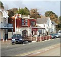
Mediterraneo, Penarth
The central, flat-roofed building is an Italian and seafood restaurant located on The Esplanade.
Image: © Jaggery
Taken: 24 Nov 2010
0.07 miles
3
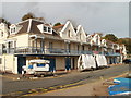
Penarth Yacht Club and Penarth Rowing Club premises
The distinctive late Victorian building, on The Esplanade, is home to the yacht club and rowing club, who also share the same website. The clubs trace their origins back to 1880.
Image: © Jaggery
Taken: 24 Nov 2010
0.07 miles
4
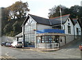
Lifeboat station and RNLI shop, Penarth
Located at the southern end of The Esplanade.
In 1861, the RNLI (Royal National Lifeboat Institution) set up a lifeboat station and boathouse on the esplanade. The building seen here dates from 1995, when a new boathouse and slipway were built to house a B class lifeboat and launching vehicle, workshop, souvenir sales outlet and improved crew facilities.
Image: © Jaggery
Taken: 24 Nov 2010
0.07 miles
5
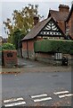
Western end of Tower Hill, Penarth
Viewed across Plymouth Road from Archer Road.
Tower Hill leads to Marine Parade.
Image: © Jaggery
Taken: 26 Oct 2021
0.07 miles
6
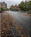
Fallen leaves, Archer Road, Penarth
Looking towards the Plymouth Road junction on October 26th 2021.
Image: © Jaggery
Taken: 26 Oct 2021
0.08 miles
7
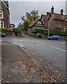
Eastern end of Archer Road, Penarth
Archer Road ends at the Plymouth Road junction.
Image: © Jaggery
Taken: 26 Oct 2021
0.08 miles
8
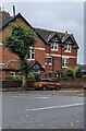
Eastern end of Sully Place, Penarth
Looking south from the corner of Archer Road and Plymouth Road.
Image: © Jaggery
Taken: 26 Oct 2021
0.08 miles
9
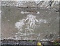
Ordnance Survey Cut Mark
This OS cut mark can be found on the wall between Nos55 & 57 Plymouth Road. It marks a point 34.424m above mean sea level.
Image: © Adrian Dust
Taken: 25 Sep 2017
0.09 miles
10

Windsor Gardens, Penarth
A pleasant clifftop walk, with views across the Bristol Channel.
Image: © Christine Johnstone
Taken: 6 Apr 2025
0.09 miles