1
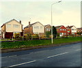
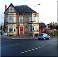
Norris Close houses, Penarth
Viewed across Redlands Road from the corner of Foxglove Rise.
The houses in Norris Close, set above the level of Redlands Road, are unusual in that the backs of the houses face each other across the Norris Close roadway. Access to the fronts of the houses is via a footpath on each side. The railings seen here are alongside one of the paths.
Image: © Jaggery
Taken: 9 Dec 2012
0.07 miles
2
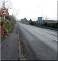
NW boundary of Penarth
A view SE along the B4267 Redlands Road. The gold on black Penarth boundary sign is on the left.
Image: © Jaggery
Taken: 9 Dec 2012
0.15 miles
3
Change of house type, Andrew Road, Penarth
Bungalows are near and behind the camera, two-storey houses are ahead.
Image: © Jaggery
Taken: 25 Nov 2016
0.16 miles
4
Andrew Road bungalows, Penarth
This part of Andrew Road is between the A4055 Barry Road to the north and the Vale of Glamorgan Line railway to the south.
Image: © Jaggery
Taken: 25 Nov 2016
0.18 miles
5
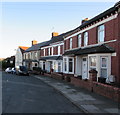
Andrew Road houses, Penarth
Near the western end of Andrew Road which extends eastwards (away from the camera) for 750 metres.
Image: © Jaggery
Taken: 25 Nov 2016
0.18 miles
6
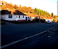
Andrew Road bungalows, Cogan
A view east past bungalows looking towards 2-storey houses.
Image: © Jaggery
Taken: 9 Dec 2012
0.19 miles
7
The A4055 Barry Road heads away from Llandough
Viewed from the edge of The Merrie Harrier. http://www.geograph.org.uk/photo/3325462
Image: © Jaggery
Taken: 9 Dec 2012
0.21 miles
8
The Merrie Harrier, Llandough
Image: © John Lord
Taken: 2 Aug 2010
0.21 miles
9
Redlands Avenue, Penarth
Viewed from Redlands Road.
Image: © Jaggery
Taken: 9 Dec 2012
0.22 miles
10
South side of The Merrie Harrier, Llandough
Pub on the corner of Barry Road and Penlan Road, near the Penarth boundary sign.
Image: © Jaggery
Taken: 9 Dec 2012
0.22 miles


