1
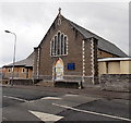
Ordnance Survey Cut Mark
This OS cut mark can be found on St Helens Road School. It marks a point 46.942m above mean sea level.
Image: © Adrian Dust
Taken: 3 Feb 2018
0.01 miles
2
St Helen's presbytery and war memorial, Barry
The presbytery (priests' house) for St Helen's RC church is located on the corner of Wyndham Street and Court Road. There is a war memorial in the form of a calvary http://www.geograph.org.uk/photo/3379262 in the grounds of the presbytery.
Image: © Jaggery
Taken: 17 Mar 2013
0.04 miles
3
St Helen's RC War Memorial, Barry
The War Memorial in the form of a calvary is located in front of St Helen's presbytery http://www.geograph.org.uk/photo/3379250
on the corner of Wyndham Street and Court Road. The dedication on the face in view
is to the men of the parish who sacrificed their lives in the Great War (1914-1918).
Image: © Jaggery
Taken: 17 Mar 2013
0.05 miles
4
St Helen's RC church Barry viewed from the SE
Viewed across Wyndham Street. The Roman Catholic church dates from 1907.
Image: © Jaggery
Taken: 17 Mar 2013
0.05 miles
5
St Helen's RC church Barry viewed from the SW
Viewed across Wyndham Street. The Roman Catholic church dates from 1907.
Image: © Jaggery
Taken: 17 Mar 2013
0.05 miles
6
Long row of houses, Pyke Street, Barry
Viewed from the corner of Crossways Street.
The row of 25 houses on the east side of Pyke Street extends for 140 metres.
Image: © Jaggery
Taken: 17 Mar 2013
0.05 miles
7
Cambrian Court, Barry
Located in Wyndham Street near the corner of Court Road, Cambrian Court contains 6 flats.
Image: © Jaggery
Taken: 17 Mar 2013
0.06 miles
8
Fenced-off site of the demolished Barry Elim Church, Barry
The church on the corner on Pyke Street and Crossways Street was demolished
in the autumn of 2012 after wind damage resulted in an unstable roof and walls.
The year 1892 is shown on the building on the left (perhaps the church hall). http://www.geograph.org.uk/photo/3378462
Image: © Jaggery
Taken: 17 Mar 2013
0.08 miles
9
Crossways Street side of Crossway Methodist Church, Barry
http://www.geograph.org.uk/photo/3378393 to a corner view.
Image: © Jaggery
Taken: 17 Mar 2013
0.08 miles
10
Church hall, Crossways Street, Barry
This building is probably the church hall of the demolished Elim Church,
the site of which is fenced off ahead. http://www.geograph.org.uk/photo/3378460
Image: © Jaggery
Taken: 17 Mar 2013
0.08 miles


