1
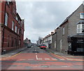
Pyke Street, Barry
Viewed across Holton Road from the corner of Lower Pyke Street.
Images hair studio http://www.geograph.org.uk/photo/3373519 is on the right.
Image: © Jaggery
Taken: 17 Mar 2013
0.02 miles
2
Church hall, Crossways Street, Barry
This building is probably the church hall of the demolished Elim Church,
the site of which is fenced off ahead. http://www.geograph.org.uk/photo/3378460
Image: © Jaggery
Taken: 17 Mar 2013
0.03 miles
3
SE corner of Holton Primary School, Barry
This part of the school occupies the corner of Holton Road and Pyke Street.
Image: © Jaggery
Taken: 17 Mar 2013
0.04 miles
4
Crossway Methodist Church, Barry
The church is on the corner of Crossways Street and Court Road.
Crossway Methodist Church was formed by the amalgamation
of Holton Road and Court Road Methodist Churches.
Image: © Jaggery
Taken: 17 Mar 2013
0.04 miles
5
Fenced-off site of the demolished Barry Elim Church, Barry
The church on the corner on Pyke Street and Crossways Street was demolished
in the autumn of 2012 after wind damage resulted in an unstable roof and walls.
The year 1892 is shown on the building on the left (perhaps the church hall). http://www.geograph.org.uk/photo/3378462
Image: © Jaggery
Taken: 17 Mar 2013
0.04 miles
6
Nursery department, Holton Primary School, Barry
Viewed across Court Road. The nursery section is located in the NW corner of Holton Primary School. The year inscribed on the building is 1895.
Image: © Jaggery
Taken: 17 Mar 2013
0.05 miles
7
Two derelict Holton Road shops, Barry
The location is the north side of Holton Road, between Pyke Street and Morel Street.
The shops used to be Cobra Tattoo Studio and Lisa's Cafe and Takeaway.
Image: © Jaggery
Taken: 17 Mar 2013
0.05 miles
8
Images hair studio, Barry
Located on the corner of Holton Road and Pyke Street.
Image: © Jaggery
Taken: 17 Mar 2013
0.05 miles
9
Court Road side of Holton Primary School, Barry
The school site borders Court Road and Holton Road. http://www.geograph.org.uk/photo/3373502
Image: © Jaggery
Taken: 17 Mar 2013
0.05 miles
10
Crossways Street side of Crossway Methodist Church, Barry
http://www.geograph.org.uk/photo/3378393 to a corner view.
Image: © Jaggery
Taken: 17 Mar 2013
0.06 miles


