1
Coronation Street, Barry
Originally named Sydenham Street, Coronation Street bends away from Dock View Road.
The street was renamed after it won the award for the best dressed street in Barry during the King George VI coronation celebrations in the spring of 1937.
Image: © Jaggery
Taken: 6 Jan 2013
0.04 miles
2
Waverley Court, Dock View Road, Barry
Flats set back from the north side of Dock View Road.
Image: © Jaggery
Taken: 18 Aug 2016
0.04 miles
3
Cwrt Trem yr Ynys flats, Barry
Cwrt Trem yr Ynys (Welsh for Island View Court) is located at the SE end of Thompson Street.
A large telephone exchange http://www.geograph.org.uk/photo/3319515 is behind the flats.
Image: © Jaggery
Taken: 17 Mar 2013
0.04 miles
4
Waverley Court, Dock View Road, Barry
Waverley Court contains 10 flats, set back from the north side of Dock View Road.
Image: © Jaggery
Taken: 6 Jan 2013
0.05 miles
5
Electricity cabinet in a corner of Barry telephone exchange
Located near the traffic light here. http://www.geograph.org.uk/photo/3319515
Two Danger notices on the cabinet show 415 volts.
A red warning notice states DO NOT PRESSURE WASH.
Image: © Jaggery
Taken: 18 Aug 2016
0.05 miles
6
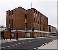
Barry telephone exchange
The Dock View Road building is on the corner of Thompson Street.
Image: © Jaggery
Taken: 6 Jan 2013
0.06 miles
7
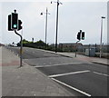
Pelican crossing, Dock View Road, Barry
A few metres from this http://www.geograph.org.uk/photo/3319529 footbridge.
Chambers Dictionary states that pelican in this context is adapted from "pedestrian light controlled crossing".
Image: © Jaggery
Taken: 18 Aug 2016
0.06 miles
8
Openreach vehicles in Dock View Road, Barry
Parked near Barry telephone exchange. http://www.geograph.org.uk/photo/3319515 The van has a Versalift. http://www.geograph.org.uk/photo/5083519
Openreach is the infrastructure division of the telecommunications company BT Group.
Image: © Jaggery
Taken: 18 Aug 2016
0.06 miles
9
Openreach Versalift van, Dock View Road, Barry
The van is fitted with a Versalift, an access platform which can be extended for working high above street level. Openreach is the infrastructure division of the telecommunications company BT Group.
Image: © Jaggery
Taken: 18 Aug 2016
0.06 miles
10
Home Bargains, Barry
Discount retailer viewed across Thompson Street.
Image: © Jaggery
Taken: 18 Aug 2016
0.07 miles


