1
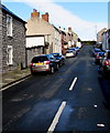
Cwrt Gwenllian, Barry
Cul-de-sac on the northwest side of Arthur Street.
Image: © Jaggery
Taken: 4 Nov 2016
0.01 miles
2
John Street, Barry
John Street is a cul-de-sac extending for 120 metres from Cardiff Road.
Image: © Jaggery
Taken: 4 Nov 2016
0.02 miles
3
VFM Trade Meat Warehouse, Barry
Located in Palmers Vale Business Centre on the west side of Palmerston Road.
Image: © Jaggery
Taken: 2 Dec 2012
0.03 miles
4
CEG Print & Graphics, Barry
Business in Palmersvale Business Centre, set back from the west side of Palmerston Road.
Image: © Jaggery
Taken: 4 Nov 2016
0.03 miles
5
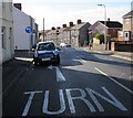
Mandatory left turn, Arthur Street, Barry
Vehicles must turn left here into Henry Street.
Image: © Jaggery
Taken: 4 Nov 2016
0.04 miles
6
Warning sign - two-way traffic, Arthur Street, Barry
At the Henry Street junction, one-way Arthur Street becomes two-way Arthur Street.
Image: © Jaggery
Taken: 4 Nov 2016
0.04 miles
7
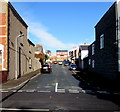
Arthur Street traffic calming, Barry
Near the Palmerston Road junction, metal posts mark a narrowing of the roadway to one lane.
Vehicles on the camera side have priority through the narrow part of the road.
Image: © Jaggery
Taken: 4 Nov 2016
0.05 miles
8
Albert Street, Barry
Albert Street is a cul-de-sac extending for 100 metres from Little Moors Hill.
Image: © Jaggery
Taken: 4 Nov 2016
0.06 miles
9
Palmerston Road Barry
Palmerston Road heads north away from Cardiff Road (the A4055).
Blue signs warn of a 7.5 weight tonne limit (across a railway bridge) 300 yards ahead.
Palmerston Road was named after the Palmer family (not Lord Palmerston) who owned much land in this area.
Image: © Jaggery
Taken: 2 Dec 2012
0.07 miles
10
Lane from Arthur Street to John Street, Barry
A white arrow painted on the lane shows that vehicles must turn right into Arthur Street.
Image: © Jaggery
Taken: 4 Nov 2016
0.07 miles


