1
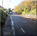
Up Little Moors Hill, Barry
Little Moors Hill ascends towards the Cadoxton area of Barry.
Image: © Jaggery
Taken: 4 Nov 2016
0.02 miles
2
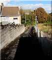
Path descending from Cadoxton railway station, Barry
The footpath descends towards Little Moors Hill.
Image: © Jaggery
Taken: 4 Nov 2016
0.02 miles
3
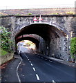
Little Moors Hill railway bridge, Cadoxton
Little Moors Hill descends towards the railway bridge located a few metres east of Cadoxton railway station.
Image: © Jaggery
Taken: 16 Jun 2010
0.02 miles
4
Long platforms at Cadoxton Railway Station
The view from the south west edge of the platforms, which are about 500 feet (150 metres) long.
The station is on the Vale of Glamorgan line, between Barry Docks station and Dinas Powys station.
Image: © Jaggery
Taken: 16 Jun 2010
0.02 miles
5
Temporary offices near Cadoxton railway station
In November 2019 the cabins are the offices of Griffiths civil engineering and construction, the firm working on the construction of the new footbridge https://www.geograph.org.uk/photo/6318615 at nearby Cadoxton station.
Image: © Jaggery
Taken: 11 Nov 2019
0.03 miles
6
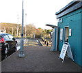
Ticket machine at the entrance to Cadoxton railway station
On November 11th 2019 a board near the ticket machine shows TICKET OFFICE NOW OPEN.
Image: © Jaggery
Taken: 11 Nov 2019
0.03 miles
7
Bilingual railway station name sign Tregatwg/Cadoxton, Barry
Near the corner of Little Moors Hill and Vere Street, at the northern end of the railway station access road.
On the side of the building THE MIR is a relic of THE ADMIRAL.
The former Admiral pub is now (November 2016) a Nisa Local convenience store. http://www.geograph.org.uk/photo/5181191
Image: © Jaggery
Taken: 4 Nov 2016
0.03 miles
8
The Admiral, Vere St, Barry
Image: © John Lord
Taken: 4 Mar 2011
0.03 miles
9
West side of Little Moors Hill railway bridges, Cadoxton
There are two parallel railway bridges http://www.geograph.org.uk/photo/3246836 over Little Moors Hill here. The nearer one carries the two tracks of the Vale of Glamorgan line immediately NE of Cadoxton station. http://www.geograph.org.uk/photo/3246730
The other one carries a single track.
The highest overhead clearance under the arch bridges is 12' 9" (3.9m).
The signs tells drivers of high vehicles to use the middle of the road.
Image: © Jaggery
Taken: 2 Dec 2012
0.03 miles
10
Two arched railway bridges over Little Moors Hill, Barry
The Network Rail nameplates on the bridges show that the Relief Lines Span is nearer the camera.
The Main Lines Span is in the background. Headroom shown is 12' 9"/3.9m.
High vehicles need to use the middle of the roadway.
Image: © Jaggery
Taken: 4 Nov 2016
0.03 miles


