1
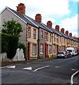
Cotswold Rise, Barry
Houses set back from Quarella Street.
Image: © Jaggery
Taken: 26 Apr 2017
0.00 miles
2
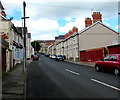
Quarella Street speed bumps, Barry
Painted white triangles draw attention to the speed bumps across Quarella Street.
Image: © Jaggery
Taken: 26 Apr 2017
0.03 miles
3
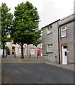
Quarella Street, Cadoxton, Barry
Viewed from the Main Street end looking towards Gladstone Road.
Image: © Jaggery
Taken: 28 Feb 2013
0.03 miles
4
Holmes Street, Barry
From Vere Street along Holmes Street towards Quarella Street.
Image: © Jaggery
Taken: 26 Apr 2017
0.03 miles
5
Western end of Holmes Street, Barry
In 2017, trees and metal posts block the passage to Quarella Street of vehicles wider than a motor bike.
Image: © Jaggery
Taken: 26 Apr 2017
0.03 miles
6
Mount Pleasant Baptist church and hall, Cadoxton, Barry
Viewed across the street named Mount Pleasant in the Cadoxton area of Barry.
The church dates from 1889. The church hall on the left was built in the early 1950s.
Image: © Jaggery
Taken: 28 Feb 2013
0.04 miles
7
Tablet recording the erection of Mount Pleasant Baptist church hall, Cadoxton, Barry
The tablet recording the erection of the hall by voluntary labour during 1950-1955 is above the hall's entrance doorway. http://www.geograph.org.uk/photo/3353048 to a view of the church and hall.
Image: © Jaggery
Taken: 28 Feb 2013
0.04 miles
8
Ordnance Survey Cut Mark
This OS cut mark can be found on No14 Foster Street. It marks a point 14.441m above mean sea level.
Image: © Adrian Dust
Taken: 3 Feb 2018
0.05 miles
9
Forster Street, Barry
Viewed from Holmes Street.
Image: © Jaggery
Taken: 26 Apr 2017
0.05 miles
10
Down Holmes Street, Barry
From trees and metal posts http://www.geograph.org.uk/photo/5366946 at the edge of Quarella Street, Holmes Street descends towards Vere Street.
Image: © Jaggery
Taken: 26 Apr 2017
0.07 miles


