1
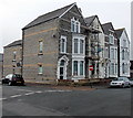
Melrose Street, Cadoxton, Barry
Viewed from the corner of Mount Pleasant.
The year 1897 is inscribed on a tablet above the upstairs window of the corner house.
Image: © Jaggery
Taken: 28 Feb 2013
0.02 miles
2
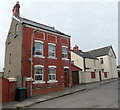
Llanover Street viewed from the south, Cadoxton, Barry
Houses on the east side of the street viewed from the Court Road end looking towards Kenilworth Road.
Image: © Jaggery
Taken: 28 Feb 2013
0.04 miles
3
Barry Mencap Social Centre, Barry
The social centre is in the former Bryn Sion Welsh Congregational Church, built in 1887 on this Court Road site between Llanover Street and Melrose Street.
Image: © Jaggery
Taken: 28 Feb 2013
0.04 miles
4
Cadoxton Christian Spiritualist church and church hall, Cadoxton, Barry
Located in Kenilworth Road, Cadoxton. The blue church hall is on the left side of the green church.
Image: © Jaggery
Taken: 28 Feb 2013
0.04 miles
5
Llanover Street, Cadoxton, Barry
Viewed across Kenilworth Road looking along Llanover Street towards Court Road.
Image: © Jaggery
Taken: 28 Feb 2013
0.05 miles
6
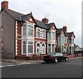
Kenilworth Road houses near the corner of Llanover Street, Cadoxton, Barry
The dark car is parked in Llanover Street. The No Entry sign shows that a one-way traffic system is in operation along the section of Kenilworth Road ahead, to the Court Road junction.
Image: © Jaggery
Taken: 28 Feb 2013
0.05 miles
7
Detached house, Mount Pleasant, Cadoxton, Barry
Below the roofline of the house on the left, there are what look like three bricked-up windows.
The bricks inside the three white frames are orientated diagonally
in contrast with the horizontality of the other bricks in the wall.
Image: © Jaggery
Taken: 28 Feb 2013
0.05 miles
8
Mount Pleasant Baptist church and hall, Cadoxton, Barry
Viewed across the street named Mount Pleasant in the Cadoxton area of Barry.
The church dates from 1889. The church hall on the left was built in the early 1950s.
Image: © Jaggery
Taken: 28 Feb 2013
0.05 miles
9
Tablet recording the erection of Mount Pleasant Baptist church hall, Cadoxton, Barry
The tablet recording the erection of the hall by voluntary labour during 1950-1955 is above the hall's entrance doorway. http://www.geograph.org.uk/photo/3353048 to a view of the church and hall.
Image: © Jaggery
Taken: 28 Feb 2013
0.05 miles
10
Mount Pleasant houses, Cadoxton, Barry
This row of 4 houses is at the corner of Melrose Street. http://www.geograph.org.uk/photo/3353079
The year 1897 is inscribed on a tablet above the upstairs window of the corner house.
Image: © Jaggery
Taken: 28 Feb 2013
0.05 miles


