1
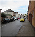
Main Street, Cadoxton, Barry
From the corner of Vere Street.
Image: © Jaggery
Taken: 4 Nov 2016
0.01 miles
2
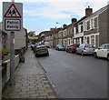
Warning sign - Patrol, Main Street, Cadoxton, Barry
The sign shows Patrol and the Welsh Patrôl.
The more usual Welsh word for Patrol is Hebryngwr, as here http://www.geograph.org.uk/photo/5071403 in nearby Dinas Powys.
Image: © Jaggery
Taken: 4 Nov 2016
0.02 miles
3
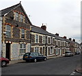
Main Street SE of Quarella Street, Cadoxton, Barry
Viewed from the corner of Quarella Street http://www.geograph.org.uk/photo/3351656 looking towards Vere Street.
Image: © Jaggery
Taken: 28 Feb 2013
0.02 miles
4
Victoria Park Road, Barry
Image: © Alex McGregor
Taken: 20 Jan 2012
0.03 miles
5
Victoria Park Road, Cadoxton
Looking east along the edge of Victoria Park.
An interesting relic of Barry's past is on the right edge of the photo. It is the remains of a gas street light. The inscription on the base reads "The Sanitary Supply Corporation Limited London & Birmingham."
I was surprised at 'sanitary' : it appears that (some of?) Barry's gas lights used sewer gas, not town gas.
Update. A correspondent informed me that in January 2011 "The gas lamp was knocked down by a lorry and the council has taken it away - never to be seen again."
Image: © Jaggery
Taken: 16 Jun 2010
0.03 miles
6
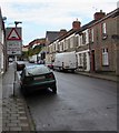
Warning sign - Humps/Twmpathau, Main Street, Cadoxton, Barry
In November 2016, the English/Welsh sign shows Humps for 280 yards/Twmpathau am 280 llath.
An October 2008 Google Earth Street View shows the text in English only.
Image: © Jaggery
Taken: 4 Nov 2016
0.04 miles
7
The Admiral pub to let, Cadoxton
A 'Pub Business To Let' sign appears on The Admiral pub, a large building located on Vere Street and extending into Northcote Terrace.
In bygone days it was the Wenvoe Arms Hotel, and was used for council meetings, coroner's inquests, and for a magistrates' court.
Image: © Jaggery
Taken: 16 Jun 2010
0.04 miles
8
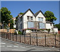
Cadoxton House, Barry
Viewed from the corner of Vere Street and Little Moors Hill, Cadoxton.
The Victorian building, owned by the Vale of Glamorgan Council, fell into disrepair and was subject to arson attacks after its use as a community centre ended in 2005.
Refurbishment work, funded by a £1.2 million Welsh Assembly grant, is now in progress. The building will become a facility catering for domestic abuse victims and people with alcohol problems.
UPDATE February 2013
Here's http://www.geograph.org.uk/photo/3350993 a view taken at the end of February 2013.
Image: © Jaggery
Taken: 16 Jun 2010
0.04 miles
9
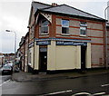
White Lightning Launderette, Cadoxton, Barry
On the corner of Vere Street and Main Street.
Image: © Jaggery
Taken: 4 Nov 2016
0.04 miles
10
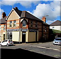
White Lightning Launderette, Cadoxton, Barry
On the corner of Vere Street and Main Street.
Image: © Jaggery
Taken: 26 Apr 2017
0.04 miles


