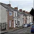
IMAGES TAKEN NEAR TO
Dylan Crescent, BARRY, CF63 1RZ

Introduction

This page details the photographs taken nearby to Dylan Crescent, CF63 1RZ by members of the Geograph project.

The Geograph project started in 2005 with the aim of publishing, organising and preserving representative images for every square kilometre of Great Britain, Ireland and the Isle of Man.

There are currently over 7.5m images from over14,400 individuals and you can help contribute to the project by visiting https://www.geograph.org.uk

Image Map


Images are licensed for reuse under creativecommons.org/licenses/by-sa/2.0
Notes
  • Clicking on the map will re-center to the selected point.
  • The higher the marker number, the further away the image location is from the centre of the postcode.

Image Listing (6 Images Found)

Images are licensed for reuse under creativecommons.org/licenses/by-sa/2.0
Image
Details
Distance
1
Cadoxton Schools, Victoria Park Road, Barry
These magnificent late Victorian schools are a dominant feature on Cadoxton Hill and can be seen from miles around.
Image: © Tony Hodge Taken: 31 Oct 2006
0.07 miles
2
Cadoxton, Barry
A north Barry suburb. The white building showing the pine end is the locally famous "King Billy" public house
Image: © Tony Hodge Taken: 31 Oct 2006
0.07 miles
3
Cadoxton School
Detail
Image: © Tony Hodge Taken: 28 Oct 2006
0.07 miles
4
Ordnance Survey Cut Mark
This OS cut mark can be found on No33 Treharne Road. It marks a point 36.580m above mean sea level.
Image: © Adrian Dust Taken: 3 Feb 2018
0.11 miles
5
Ordnance Survey Cut Mark
This OS cut mark can be found on No16 Bridge Street. It marks a point 29.163m above mean sea level.
Image: © Adrian Dust Taken: 3 Feb 2018
0.18 miles
6
Beverley Street, Cadoxton, Barry
Beverley Street is an 80 metre long cul-de-sac. Viewed from the Main Street end.
Image: © Jaggery Taken: 28 Feb 2013
0.25 miles