1
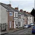
Cadoxton School
Detail
Image: © Tony Hodge
Taken: 28 Oct 2006
0.10 miles
2
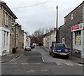
Cadoxton, Barry
A north Barry suburb. The white building showing the pine end is the locally famous "King Billy" public house
Image: © Tony Hodge
Taken: 31 Oct 2006
0.10 miles
3
Cadoxton Schools, Victoria Park Road, Barry
These magnificent late Victorian schools are a dominant feature on Cadoxton Hill and can be seen from miles around.
Image: © Tony Hodge
Taken: 31 Oct 2006
0.10 miles
4
Ordnance Survey Cut Mark
This OS cut mark can be found on No33 Treharne Road. It marks a point 36.580m above mean sea level.
Image: © Adrian Dust
Taken: 3 Feb 2018
0.12 miles
5
Beverley Street, Cadoxton, Barry
Beverley Street is an 80 metre long cul-de-sac. Viewed from the Main Street end.
Image: © Jaggery
Taken: 28 Feb 2013
0.18 miles
6
Ty Cerrig, Cadoxton , Barry,
Built in 1990, Ty Cerrig is located at the southern end of Robins Lane, near the junctions with Court Road, Beverley Street and Main Street. Managed by the Cadarn Housing Group, Ty Cerrig contains
12 1-bedroom rented flats with a community alarm service. New residents must be at least 55 years old.
Image: © Jaggery
Taken: 28 Feb 2013
0.18 miles
7
Ordnance Survey Cut Mark
This OS cut mark can be found on No16 Bridge Street. It marks a point 29.163m above mean sea level.
Image: © Adrian Dust
Taken: 3 Feb 2018
0.21 miles
8
Abingdon Street, Cadoxton, Barry
Abingdon Street is a 60 metre long cul-de-sac.
Viewed across Main Street past a Spar http://www.geograph.org.uk/photo/3351673 on the corner.
Image: © Jaggery
Taken: 28 Feb 2013
0.21 miles
9
Ordnance Survey Cut Mark
This OS cut mark can be found on an old garage in Robins Lane. It marks a point 34.490m above mean sea level.
Image: © Adrian Dust
Taken: 3 Feb 2018
0.22 miles
10
Southern end of Robins Lane, Cadoxton, Barry
A one-way system, away from the camera, operates along Robins Lane.
Viewed across Barry Road, Cadoxton.
Image: © Jaggery
Taken: 28 Feb 2013
0.22 miles


