1
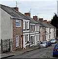
Ordnance Survey Cut Mark
This OS cut mark can be found on No16 Bridge Street. It marks a point 29.163m above mean sea level.
Image: © Adrian Dust
Taken: 3 Feb 2018
0.02 miles
2
Children's Playground
Children's playground in Cadoxton.
Image: © Alan Hughes
Taken: 6 Jun 2017
0.09 miles
3
Ordnance Survey Cut Mark
This OS cut mark can be found on No33 Treharne Road. It marks a point 36.580m above mean sea level.
Image: © Adrian Dust
Taken: 3 Feb 2018
0.10 miles
4
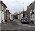
Beverley Street, Cadoxton, Barry
Beverley Street is an 80 metre long cul-de-sac. Viewed from the Main Street end.
Image: © Jaggery
Taken: 28 Feb 2013
0.10 miles
5
Victoria Gardens, Cadoxton, Barry
Victoria Gardens is an open space, about 60 metres by 20 metres, on the east side of Church Road. Cadoxton Methodist Church http://www.geograph.org.uk/photo/3351276 is in the background.
Image: © Jaggery
Taken: 28 Feb 2013
0.11 miles
6
Cadoxton Methodist church and hall, Barry
Located on the north side of Church Road, Cadoxton, Barry.
The church was built in 1862, when Cadoxton was a small village, separate from Barry, which was also a small village at that time, with a population of less than 100. The date stone on the hall on the right shows 1931.
Image: © Jaggery
Taken: 28 Feb 2013
0.11 miles
7
Cadoxton Methodist church and hall, Barry
The church was built in 1862, when Cadoxton was a small village, separate from Barry, which was also a small village at that time, with a population of less than 100. The date stone on the hall http://www.geograph.org.uk/photo/5187178 on the right shows 1931.
Cadoxton is part of the Vale of Glamorgan Circuit of the Methodist Church which has churches in Barry, Dinas Powys, Penarth and St Athan.
Image: © Jaggery
Taken: 4 Nov 2016
0.11 miles
8
Cadoxton Methodist church hall, Barry
Located in Church Road alongside the church. http://www.geograph.org.uk/photo/5187176
Image: © Jaggery
Taken: 4 Nov 2016
0.11 miles
9
Pathside benches, Cadoxton, Barry
Below Church Road. Bridge Street is on the right.
Image: © Jaggery
Taken: 4 Nov 2016
0.12 miles
10
Abingdon Street, Cadoxton, Barry
Abingdon Street is a 60 metre long cul-de-sac.
Viewed across Main Street past a Spar http://www.geograph.org.uk/photo/3351673 on the corner.
Image: © Jaggery
Taken: 28 Feb 2013
0.12 miles


