
IMAGES TAKEN NEAR TO
Port Road West, BARRY, CF62 8PP
Introduction
This page details the photographs taken nearby to Port Road West, CF62 8PP by members of the Geograph project.
The Geograph project started in 2005 with the aim of publishing, organising and preserving representative images for every square kilometre of Great Britain, Ireland and the Isle of Man.

There are currently over 7.5m images from over14,400 individuals and you can help contribute to the project by visiting https://www.geograph.org.uk
Image Map
Images are licensed for reuse under creativecommons.org/licenses/by-sa/2.0
Notes
- Clicking on the map will re-center to the selected point.
- The higher the marker number, the further away the image location is from the centre of the postcode.
Image Listing (37 Images Found)
Images are licensed for reuse under creativecommons.org/licenses/by-sa/2.0
Image
Details
Distance
1
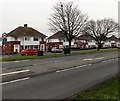
Port Road West houses, Barry
The houses are NE of the Highlight Lane junction. http://www.geograph.org.uk/photo/3285712
Image: © Jaggery
Taken: 6 Jan 2013
0.01 miles
2
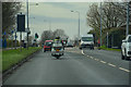
Barry : Port Road West A4226
Heading along Port Road West.
Image: © Lewis Clarke
Taken: 23 Mar 2019
0.02 miles
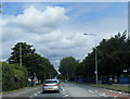
4
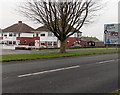
Port Road West approaches the Calcot Road junction, Barry
A view across Port Road West looking towards Brynhill Close.
Port Road West becomes Port Road East beyond the roundabout ahead.
Image: © Jaggery
Taken: 6 Jan 2013
0.06 miles
5
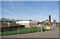
Ysgol Bro Morgannwg, Barry
A Welsh medium comprehensive school serving the whole of the Vale of Glamorgan
Image: © Tony Hodge
Taken: 3 Nov 2006
0.06 miles

7

Highlight Lane, Barry
Viewed across Port Road West. Now part of a housing estate built in the 1970s, Highlight Lane
formerly ran through open countryside to Highlight Farm, which is more than five hundred years old.
Image: © Jaggery
Taken: 6 Jan 2013
0.07 miles
8
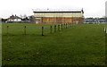
Barry Sports Centre
A view from Port Road West of an edge of the Highfield Road sports centre.
Image: © Jaggery
Taken: 6 Jan 2013
0.10 miles
9
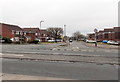
Liscum Way, Barry
Viewed across Port Road West.
Liscum Way is in an area of modern houses in the Colcot area in the north of Barry.
Image: © Jaggery
Taken: 6 Jan 2013
0.11 miles
10
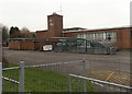
Clock tower, Barry Comprehensive School
Viewed from Port Road West. Situated at the northern edge of Barry, the school has a boys-only section (ages 11-16) and a co-educational 6th form (ages 16-18).
Image: © Jaggery
Taken: 6 Jan 2013
0.12 miles