IMAGES TAKEN NEAR TO
Porthkerry Road, BARRY, CF62 7EP
Introduction
This page details the photographs taken nearby to Porthkerry Road, CF62 7EP by members of the Geograph project.
The Geograph project started in 2005 with the aim of publishing, organising and preserving representative images for every square kilometre of Great Britain, Ireland and the Isle of Man.

There are currently over 7.5m images from over14,400 individuals and you can help contribute to the project by visiting https://www.geograph.org.uk
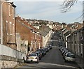
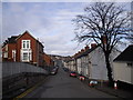
Image Map
Images are licensed for reuse under creativecommons.org/licenses/by-sa/2.0
Notes
- Clicking on the map will re-center to the selected point.
- The higher the marker number, the further away the image location is from the centre of the postcode.
Image Listing (266 Images Found)
Images are licensed for reuse under creativecommons.org/licenses/by-sa/2.0
Image
Details
Distance
1
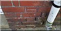
Ordnance Survey Cut Mark
This OS cut mark can be found on No105 Princes Street. It marks a point 31.151m above mean sea level.
Image: © Adrian Dust
Taken: 28 Feb 2018
0.02 miles
3
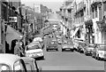
High Street, Barry in the 1970's
Image: © Christopher R Ware
Taken: 26 Apr 2007
0.05 miles
4
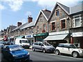
High Street post office, Barry
The post office is at 18 High Street, viewed from near the corner of Island Road in the early afternoon on a Saturday in July. A one-way traffic system operates on High Street and several other adjacent streets. In 2011, it must be unusual for parking to be allowed on both sides of a High Street.
Image: © Jaggery
Taken: 9 Jul 2011
0.05 miles
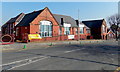
5
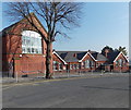
South side of Romilly Primary School, Barry
The school occupies a large site on the corner of Park Crescent and Romilly Road.
These school buildings are on the Romilly Road side.
Image: © Jaggery
Taken: 5 Mar 2013
0.06 miles
6
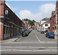
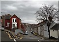
Market Street, Barry
Towards High Street and York Place from Broad Street.
Image: © Jaggery
Taken: 18 Aug 2016
0.07 miles
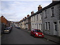
8
Queen St, Barry
The street name sign on the gable end of the house on the right, which should read "Market St", has been removed. Street name signs in nearby High St have been painted over. (See Image and Image). It seems reminiscent of wartime attempts to confuse any invading troops.
Image: © John Lord
Taken: 20 Mar 2011
0.08 miles
9
Part of Romilly Primary School used for Sunday worship by Bethel Baptist Church, Barry
Viewed across Romilly Road. A yellow Welcome banner on the fence shows that
the Bethel Baptist Church congregation worships here (on Sunday mornings).
The church building http://www.geograph.org.uk/photo/3361919 on the corner of Harbour Road and St Nicholas Road
is used for Sunday evening worship.
Image: © Jaggery
Taken: 5 Mar 2013
0.08 miles