IMAGES TAKEN NEAR TO
Aberystwyth Crescent, BARRY, CF62 7EH

Introduction

This page details the photographs taken nearby to Aberystwyth Crescent, CF62 7EH by members of the Geograph project.

The Geograph project started in 2005 with the aim of publishing, organising and preserving representative images for every square kilometre of Great Britain, Ireland and the Isle of Man.

There are currently over 7.5m images from over14,400 individuals and you can help contribute to the project by visiting https://www.geograph.org.uk

Image Map


Images are licensed for reuse under creativecommons.org/licenses/by-sa/2.0
Notes
  • Clicking on the map will re-center to the selected point.
  • The higher the marker number, the further away the image location is from the centre of the postcode.

Image Listing (149 Images Found)

Images are licensed for reuse under creativecommons.org/licenses/by-sa/2.0
  • ...
Image
Details
Distance
1
Trinity Street, Barry
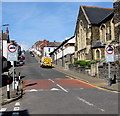
Trinity Street climbs away from Holy Trinity Presbyterian Church. http://www.geograph.org.uk/photo/1905053 The No Entry sign on the left is at the edge of High Street.
Image: © Jaggery Taken: 9 Jul 2011
0.03 miles
2
Ysgol Sant Baruc, Barry
Located on the north side of St Paul's Avenue, adjacent to High Street Primary School. http://www.geograph.org.uk/photo/3300209 Ysgol Sant Baruc is a Welsh medium primary school, where lessons are taught using the medium of the Welsh language.
Image: © Jaggery Taken: 6 Jan 2013
0.03 miles
3
Trinity Street, Barry
The sun sets on Trinity Street. Barry Island is in the distance. (This view was used on BBC3's 'Gavin and Stacey' series as a 'scene-setter'.)
Image: © Christopher R Ware Taken: 2 Aug 2007
0.03 miles
4
Trinity St, Barry
Image: © John Lord Taken: 20 Mar 2011
0.04 miles
5
Trinity Street, Barry
Trinity Street climbs away from the junction of High Street and St Paul's Avenue, towards Jenner Road.
Image: © Jaggery Taken: 6 Jan 2013
0.04 miles
6
Up Trinity Street, Barry
This part of Trinity Street is between High Street (near the camera) and Queen Street. Holy Trinity Presbyterian Church https://www.geograph.org.uk/photo/1905053 is on the right. Vehicle weight restriction (except for access) signs in September 2019 have replaced No Entry signs shown in a July 2015 Google Street View.
Image: © Jaggery Taken: 8 Sep 2019
0.04 miles
7
High Street Primary School, Barry
The confusinlgy-named High Street Primary School is located on the north side of St Paul's Avenue, about 100 metres east of the eastern end of High Street. There is another primary school adjacent to this one, just out of shot on the left. It is Ysgol Sant Baruc, http://www.geograph.org.uk/photo/3300215 a Welsh medium school
Image: © Jaggery Taken: 6 Jan 2013
0.04 miles
8
Holy Trinity Presbyterian Church viewed from the east, Barry
A view along St Paul's Avenue toward the church occupying a corner site on Trinity Street. The first services held here were in June 1895.
Image: © Jaggery Taken: 6 Jan 2013
0.05 miles
9
Southwest end of St Paul's Avenue, Barry
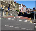
Looking to the NE from the corner of High Street and Trinity Street past one-way signs. The speed limit drops to 20mph on the approach to schools. Holy Trinity Presbyterian Church https://www.geograph.org.uk/photo/1905053 is on the left.
Image: © Jaggery Taken: 8 Sep 2019
0.05 miles
10
Trinity Street, Barry
From Broad Street along Trinity Street towards High Street and St Paul's Avenue. RAN Hire & Sales Ltd shop http://www.geograph.org.uk/photo/5085834 is on the left.
Image: © Jaggery Taken: 18 Aug 2016
0.05 miles
  • ...