1
Cowbridge Road bus stop and shelter near Rock Road, St Athan
In September 2019 this is a stop on NAT Group's bus route 303 from Bridgend to Barry.
Image: © Jaggery
Taken: 17 Sep 2019
0.03 miles
2
School/Ysgol direction sign, Cowbridge Road, St Athan
English/Welsh sign pointing left to Rock Road which leads to St Athan Primary School.
Image: © Jaggery
Taken: 17 Sep 2019
0.05 miles
3
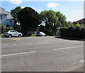
Junction of Cowbridge Road and Rock Road, St Athan
The cars are in Rock Road.
Image: © Jaggery
Taken: 17 Sep 2019
0.05 miles
4
Cowbridge Road School/Ysgol direction sign, St Athan
The English/Welsh sign points left towards Rock Road which leads to St Athan Primary School.
Image: © Jaggery
Taken: 13 Sep 2019
0.05 miles
5
Bingle Lane off Cowbridge Road - St Athan
This small lane contains six semi-detached houses on one side that were once 'Ministry' houses, as in Ministry of Defence, and would have been the homes of personnel associated with the RAF camp.
Image: © Mick Lobb
Taken: 7 Aug 2009
0.07 miles
6
Wales & West Utilities gas installation, Cowbridge Road, St Athan
In a locked enclosure above the west side of Cowbridge Road.
Image: © Jaggery
Taken: 13 Sep 2019
0.09 miles
7
Cowbridge Road - St Athan
There is a considerable dip in the road at this point and was at one time, perhaps still is,a notorious speeding point as drivers accelerated down one slope to ease their passage up the other. Needless to say, many paid the price in speeding fines!
Image: © Mick Lobb
Taken: 3 May 2009
0.09 miles
8
A cottage with shutters, St Athan
Image: © Mick Lobb
Taken: 3 May 2009
0.11 miles
9
St John's Hill, St Athan
From the east side of Cowbridge Road, one-way St John's Hill leads to Rock Road.
Image: © Jaggery
Taken: 17 Sep 2019
0.11 miles
10
Rectory Road looking north
Image: © Colin Pyle
Taken: 16 Jul 2012
0.12 miles


