
IMAGES TAKEN NEAR TO
Pleasant Harbour, BARRY, CF62 3DB
Introduction
This page details the photographs taken nearby to Pleasant Harbour, CF62 3DB by members of the Geograph project.
The Geograph project started in 2005 with the aim of publishing, organising and preserving representative images for every square kilometre of Great Britain, Ireland and the Isle of Man.

There are currently over 7.5m images from over14,400 individuals and you can help contribute to the project by visiting https://www.geograph.org.uk
Image Map
Images are licensed for reuse under creativecommons.org/licenses/by-sa/2.0
Notes
- Clicking on the map will re-center to the selected point.
- The higher the marker number, the further away the image location is from the centre of the postcode.
Image Listing (68 Images Found)
Images are licensed for reuse under creativecommons.org/licenses/by-sa/2.0
Image
Details
Distance
1
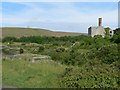
East Aberthaw Lagoon
This area, at the estuary of the River Thaw was once a busy port. This ruin was once, I understand, a lime kiln. The landscape was substantially altered by the building of Aberthaw Power Station when the river was straightened and the estuary became a tidal lagoon. Much of the nearby area is covered by ash from the station but it remains a site of importance for wild life. Since the tip was extended in the late 1980's the reed beds have begun to regenerate and are now used by both Reed and Sedge Warblers. An Aquatic Warbler was trapped and ringed here, also in the '80's, and it is to be hoped that they, as well as other species that once used the area, might well be seen again as the area develops further.
Image: © Mick Lobb
Taken: 17 Jun 2008
0.01 miles
3
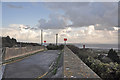
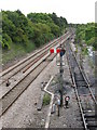
Lane to the coast - East Aberthaw
A bridge crosses the adjacent railway line and the lane affords access to land occupied by Aberthaw Power Station and a footpath to the beach. Across the channel lies the coast of Somerset.
Image: © Mick Lobb
Taken: 4 Nov 2009
0.05 miles
4

Linnet and fresh spring growth - East Aberthaw
The gorse of the limestone cliffs and foreshore in the vicinity provides ideal habitat for these little finches.
Image: © Mick Lobb
Taken: 19 Apr 2011
0.05 miles
5
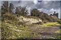
Sea Wall, Pleasant Harbour
This is part of the original sea wall for Pleasant Harbour at Aberthaw. It is now protected from the sea by a new sea wall built to protect the power station.
The port of Pleasant Harbour was served by the Port Road running from Cardiff which was only a very small town at the time.
The lime kilns are in the background.
Image: © Guy Butler-Madden
Taken: 13 Feb 2014
0.06 miles
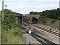
7
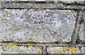
Ordnance Survey Cut Mark
This OS cut mark can be found on the NW parapet of the railway bridge. It marks a point 31.878m above mean sea level.
Image: © Adrian Dust
Taken: 11 Mar 2018
0.07 miles
8
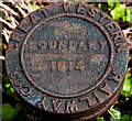
Great Western Railway Boundary Marker
This marker is where the GWR met the lime kiln's tramway system.
Image: © Guy Butler-Madden
Taken: 19 May 2011
0.07 miles
9
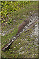
Lime Kiln Tramway Track Detail
This appears to be the rope guide for the lime kiln's tramway.
Another view of the track is at Image
Image: © Guy Butler-Madden
Taken: 19 May 2011
0.08 miles
10

Lime Kilns
These are the two much larger kilns built just to the north of the main building. A tramway ran between the buildings.
There are some details about the history of the site on Wikipedia http://en.wikipedia.org/wiki/Aberthaw_Lime_Works
Image: © Guy Butler-Madden
Taken: 26 Nov 2009
0.08 miles