IMAGES TAKEN NEAR TO
St. Brides-Super-Ely, CARDIFF, CF5 6EY

Introduction

This page details the photographs taken nearby to CF5 6EY by members of the Geograph project.

The Geograph project started in 2005 with the aim of publishing, organising and preserving representative images for every square kilometre of Great Britain, Ireland and the Isle of Man.

There are currently over 7.5m images from over14,400 individuals and you can help contribute to the project by visiting https://www.geograph.org.uk

Image Map


Images are licensed for reuse under creativecommons.org/licenses/by-sa/2.0
Notes
  • Clicking on the map will re-center to the selected point.
  • The higher the marker number, the further away the image location is from the centre of the postcode.

Image Listing (18 Images Found)

Images are licensed for reuse under creativecommons.org/licenses/by-sa/2.0
Image
Details
Distance
1
Phone box at tight bend, St Bride's-super-Ely
Image: © John Lord Taken: 30 Aug 2008
0.02 miles
2
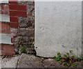
Ordnance Survey Rivet
This OS rivet can be found on the lower step leading to the stile north side of the road junction. It marks a point 35.994m above mean sea level.
Image: © Adrian Dust Taken: 26 Sep 2022
0.02 miles
3
Junction & phone box at St. Bride's-super-Ely
Image: © Nick Mutton 01329 000000 Taken: 22 Sep 2007
0.03 miles
4
OS Rivet in step, St Brides-super-Ely
A nice example of an OS Rivet in the bottom step leading up to a stile at a road junction in the centre of the village.
Image: © Father Ted Taken: 7 Jul 2020
0.03 miles
5
Ordnance Survey Cut Mark
This OS cut mark can be found on the SW face of St Ffraid's Church. It marks a point 31.760m above mean sea level.
Image: © Adrian Dust Taken: 9 Apr 2016
0.09 miles
6
Church of St Ffraid, St Brides-super-Ely
This is a Norman church that underwent significant restoration with many features added from other local buildings including the demolished chapel of St Mary at Sant-y-Nyll. The tower is 13th century. The church is a Grade II listed building.
Image: © Colin Cheesman Taken: 18 Jun 2021
0.09 miles
7
Church Porch and Tower
Porch and Tower of St.Bride's Church, St.Bride's super Ely.
Image: © Alan Hughes Taken: 19 Feb 2016
0.09 miles
8
St.Bride's Church
13th Century Norman Church of St.Bride, St.Bride's super Ely.
Image: © Alan Hughes Taken: 19 Feb 2016
0.09 miles
9
Benchmark, Plas Celyn, St Brides-super-Ely
A cut benchmark on the side of Plas Celyn in St Brides-super-Ely.
Image: © Father Ted Taken: 7 Jul 2020
0.10 miles
10
Llansanffraid ar Elai / St Brides Super Ely
Eglwys Llansanffraid ar Elai. St Brides Super Ely Church.
Image: © Alan Richards Taken: 12 Sep 2010
0.10 miles