1
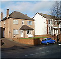
Cardiff : Cowbridge Road West flats opposite Colin Way
Modern flats on the north side of the road, opposite Ely Methodist Church and Colin Way.
Image: © Jaggery
Taken: 19 Nov 2010
0.02 miles
2
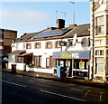
William Hill, Ely, Cardiff
Betting shop at 14 Cowbridge Road West. Its neighbours on the left are a house with an array of 12 solar panels, and Ely Bridge Chiropractic Clinic. On the right side of William Hill's premises is the former White Lion Hotel, now converted to flats. http://www.geograph.org.uk/photo/2167030
Image: © Jaggery
Taken: 19 Nov 2010
0.02 miles
3
Apartment building for sale, Ely, Cardiff
Located on the corner of Cowbridge Road West and Mill Road. Built in 1894 as the White Lion Hotel, the building has been converted into 10 flats. At the date of the photo, November 2010, the building was for sale for £650,000.
Image: © Jaggery
Taken: 19 Nov 2010
0.02 miles
4
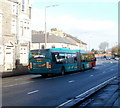
Cardiff bendy bus
The bus is on Cowbridge Road West (A48), heading towards the city centre from Ely. On the back of the bus, a notice states
long bendy bus (18 metres, about 60 feet)
cyclists take care when passing.
http://www.geograph.org.uk/photo/2166888 to the inside of a bendy bus.
Image: © Jaggery
Taken: 19 Nov 2010
0.02 miles
5
Ordnance Survey Cut Mark
This OS cut mark can be found on the Ely Methodist Church. It marks a point 11.192m above mean sea level.
Image: © Adrian Dust
Taken: 21 Oct 2018
0.03 miles
6
Family Dental Centre, Ely, Cardiff
Dentists at 26A Cowbridge Road West, next door to the Conservative Club. http://www.geograph.org.uk/photo/2167282
Image: © Jaggery
Taken: 19 Nov 2010
0.06 miles
7
Ely (Cardiff) Conservative Club
Located at 24-26 Cowbridge Road West. A notice in an upstairs window states that function rooms and a skittle alley are available (for hire). New members are welcome.
Image: © Jaggery
Taken: 19 Nov 2010
0.06 miles
8
Ordnance Survey Cut Mark
This OS cut mark can be found on the old warehouse building on Mill Road. It marks a point 9.775m above mean sea level.
Image: © Adrian Dust
Taken: 21 Oct 2018
0.07 miles
9
St David's Church Room, Ely
Located on the north side of Clarke Street, opposite Millbank Primary School. http://www.geograph.org.uk/photo/2166954
An inscription on the side of the building shows 1897. The St David's Church website states that the building was sold in the 1980s. There was no indication at the site as to its current use.
Image: © Jaggery
Taken: 19 Nov 2010
0.07 miles
10
Millbank Primary School, Cardiff
The school is on Clarke Street, Ely. It was formerly named Ely Infants School.
Image: © Jaggery
Taken: 19 Nov 2010
0.07 miles


