IMAGES TAKEN NEAR TO
Highbury Place, CARDIFF, CF5 4LP

Introduction

This page details the photographs taken nearby to Highbury Place, CF5 4LP by members of the Geograph project.

The Geograph project started in 2005 with the aim of publishing, organising and preserving representative images for every square kilometre of Great Britain, Ireland and the Isle of Man.

There are currently over 7.5m images from over14,400 individuals and you can help contribute to the project by visiting https://www.geograph.org.uk

Image Map


Images are licensed for reuse under creativecommons.org/licenses/by-sa/2.0
Notes
  • Clicking on the map will re-center to the selected point.
  • The higher the marker number, the further away the image location is from the centre of the postcode.

Image Listing (18 Images Found)

Images are licensed for reuse under creativecommons.org/licenses/by-sa/2.0
Image
Details
Distance
1
Grand Avenue, Ely.
Looking along Grand Avenue in a westerly direction, at its junction with Wilson Road.
Image: © Peter Wasp Taken: 31 Mar 2007
0.06 miles
2
Shops in Ely, Cardiff
Image: © Gareth James Taken: 7 Jul 2010
0.09 miles
3
Sevenoaks Rd, Ely, Cardiff
Image: © John Lord Taken: 9 Jun 2010
0.11 miles
4
Westway Surgery, Cardiff
Located at 1 Wilson Road, on the corner of Cowbridge Road West. A pharmacy is next door.
Image: © Jaggery Taken: 19 Nov 2010
0.12 miles
5
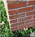
Ordnance Survey Cut Mark
This OS cut mark can be found on No8 Wilson Road. It marks a point 35.918m above mean sea level.
Image: © Adrian Dust Taken: 21 Oct 2018
0.12 miles
6
Ordnance Survey Cut Mark
This OS cut mark can be found on the school wall, Grand Avenue. It marks a point 44.757m above mean sea level.
Image: © Adrian Dust Taken: 21 Oct 2018
0.14 miles
7
Dusty Forge
Formerly a local pub, the Dusty Forge is now a community centre serving Ely.
Image: © Alan Hughes Taken: 3 May 2018
0.15 miles
8
Ordnance Survey Cut Mark
This OS cut mark can be found on No290 Grand Avenue. It marks a point 55.443m above mean sea level.
Image: © Adrian Dust Taken: 21 Oct 2018
0.16 miles
9
Cardiff : Cowbridge Road West houses between Crown House and Wilson Road
Houses on the north side of Cowbridge Road West. At the right edge of the view is Blockbuster Video, located in Crown House. http://www.geograph.org.uk/photo/2167427
Image: © Jaggery Taken: 19 Nov 2010
0.16 miles
10
Cardiff : Cowbridge Road West houses east of Dusty Forge
Houses on the north side of Cowbridge Road West (A48). The Dusty Forge http://www.geograph.org.uk/photo/2167514 is just beyond the left edge of the view.
Image: © Jaggery Taken: 19 Nov 2010
0.16 miles