
IMAGES TAKEN NEAR TO
Vachell Road, CARDIFF, CF5 4HF
Introduction
This page details the photographs taken nearby to Vachell Road, CF5 4HF by members of the Geograph project.
The Geograph project started in 2005 with the aim of publishing, organising and preserving representative images for every square kilometre of Great Britain, Ireland and the Isle of Man.

There are currently over 7.5m images from over14,400 individuals and you can help contribute to the project by visiting https://www.geograph.org.uk
Image Map
Images are licensed for reuse under creativecommons.org/licenses/by-sa/2.0
Notes
- Clicking on the map will re-center to the selected point.
- The higher the marker number, the further away the image location is from the centre of the postcode.
Image Listing (15 Images Found)
Images are licensed for reuse under creativecommons.org/licenses/by-sa/2.0
Image
Details
Distance
1
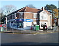
Amroth Road Post Office, Cardiff
Located inside Duggans Stores, (a Mace Express Store) at 109-111 Cowbridge Road West, on the corner of Amroth Road.
Image: © Jaggery
Taken: 19 Nov 2010
0.12 miles
3
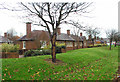
Pensioners' Houses - Ely, Cardiff
The backs of the houses on Cowbridge Road West, Ely, Cardiff
Image: © Tony Hodge
Taken: 30 Nov 2006
0.15 miles
4
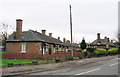
Pensioners' Houses (fronts), Ely , Cardiff
Image: © Tony Hodge
Taken: 30 Nov 2003
0.15 miles
5
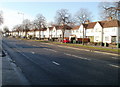
Cardiff : Cowbridge Road West houses west of Amroth Road
The view to the SW from near Amroth Road post office and stores. http://www.geograph.org.uk/photo/2167366
Image: © Jaggery
Taken: 19 Nov 2010
0.15 miles
6

Ordnance Survey Cut Mark
This OS cut mark can be found on the wall SE side of Cowbridge Road West. It marks a point 14.661m above mean sea level.
Image: © Adrian Dust
Taken: 23 Sep 2021
0.17 miles
7
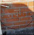
Ordnance Survey Cut Mark
This OS cut mark can be found on No4 Charteris Road. It marks a point 18.251m above mean sea level.
Image: © Adrian Dust
Taken: 21 Oct 2018
0.18 miles
8
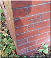
Ordnance Survey Cut Mark
This OS cut mark can be found on No26 Grand Avenue. It marks a point 14.758m above mean sea level.
Image: © Adrian Dust
Taken: 21 Oct 2018
0.18 miles
9

Silver Jubilee Cottages, Ely, Cardiff
Located on Cowbridge Road West, opposite the fire station. http://www.geograph.org.uk/photo/289178
Image: © Jaggery
Taken: 19 Nov 2010
0.20 miles
10
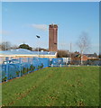
Mobile phone transmitters on Ely Fire Station training tower
The transmitters are about 20 metres (65 feet) above ground level at the top of the fire station http://www.geograph.org.uk/photo/289178 training tower.
Image: © Jaggery
Taken: 19 Nov 2010
0.20 miles