
IMAGES TAKEN NEAR TO
Heol Y Felin, CARDIFF, CF5 4BX
Introduction
This page details the photographs taken nearby to Heol Y Felin, CF5 4BX by members of the Geograph project.
The Geograph project started in 2005 with the aim of publishing, organising and preserving representative images for every square kilometre of Great Britain, Ireland and the Isle of Man.

There are currently over 7.5m images from over14,400 individuals and you can help contribute to the project by visiting https://www.geograph.org.uk
Image Map
Images are licensed for reuse under creativecommons.org/licenses/by-sa/2.0
Notes
- Clicking on the map will re-center to the selected point.
- The higher the marker number, the further away the image location is from the centre of the postcode.
Image Listing (25 Images Found)
Images are licensed for reuse under creativecommons.org/licenses/by-sa/2.0
Image
Details
Distance
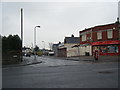
2
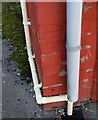
Ordnance Survey Cut Mark
This OS cut mark can be found on No92 Heol Muston. It marks a point 16.048m above mean sea level.
Image: © Adrian Dust
Taken: 21 Oct 2018
0.03 miles
3
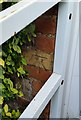
Ordnance Survey Cut Mark
This OS cut mark can be found on No82 Mill Road. It marks a point 12.832m above mean sea level.
Image: © Adrian Dust
Taken: 21 Oct 2018
0.06 miles
5
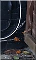
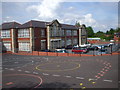
Ordnance Survey Cut Mark
This OS cut mark can be found on No55 Plymouth Wood Road. It marks a point 20.611m above mean sea level.
Image: © Adrian Dust
Taken: 21 Oct 2018
0.14 miles
6
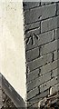
Ordnance Survey Cut Mark
This OS cut mark can be found on No47 Heol Muston. It marks a point 18.099m above mean sea level.
Image: © Adrian Dust
Taken: 21 Oct 2018
0.14 miles
7
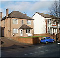
Family Dental Centre, Ely, Cardiff
Dentists at 26A Cowbridge Road West, next door to the Conservative Club. http://www.geograph.org.uk/photo/2167282
Image: © Jaggery
Taken: 19 Nov 2010
0.15 miles
8
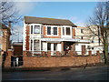
Ely (Cardiff) Conservative Club
Located at 24-26 Cowbridge Road West. A notice in an upstairs window states that function rooms and a skittle alley are available (for hire). New members are welcome.
Image: © Jaggery
Taken: 19 Nov 2010
0.15 miles
9
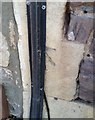
Ordnance Survey Cut Mark
This OS cut mark can be found on the old warehouse building on Mill Road. It marks a point 9.775m above mean sea level.
Image: © Adrian Dust
Taken: 21 Oct 2018
0.17 miles
10
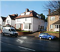
Cowbridge Road West houses , Cardiff
Houses adjacent to the Family Dental Centre. http://www.geograph.org.uk/photo/2167297
Image: © Jaggery
Taken: 19 Nov 2010
0.19 miles